.jpg)
Land and Sea Surveying Concepts, INC.1605 CHASE HAMMOCK ROADMERRITT ISLAND, FL. 32953PHONE: 321.454.6310 FAX: 321.454.6998
.jpg)
.jpg)
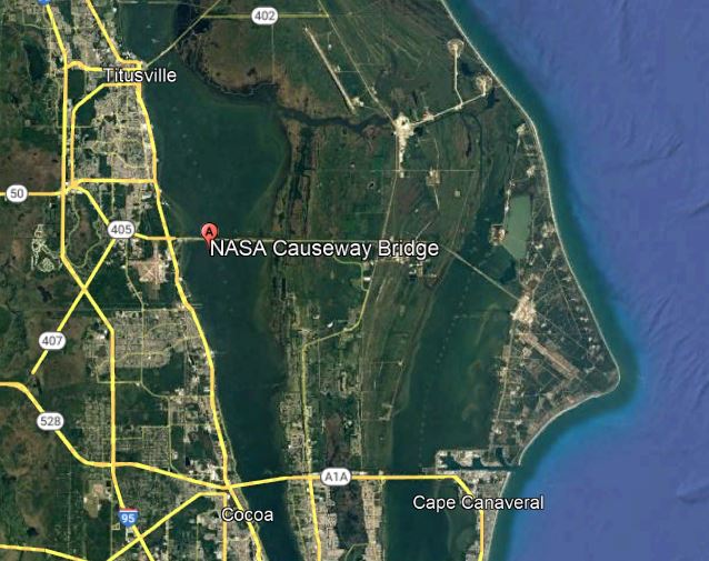
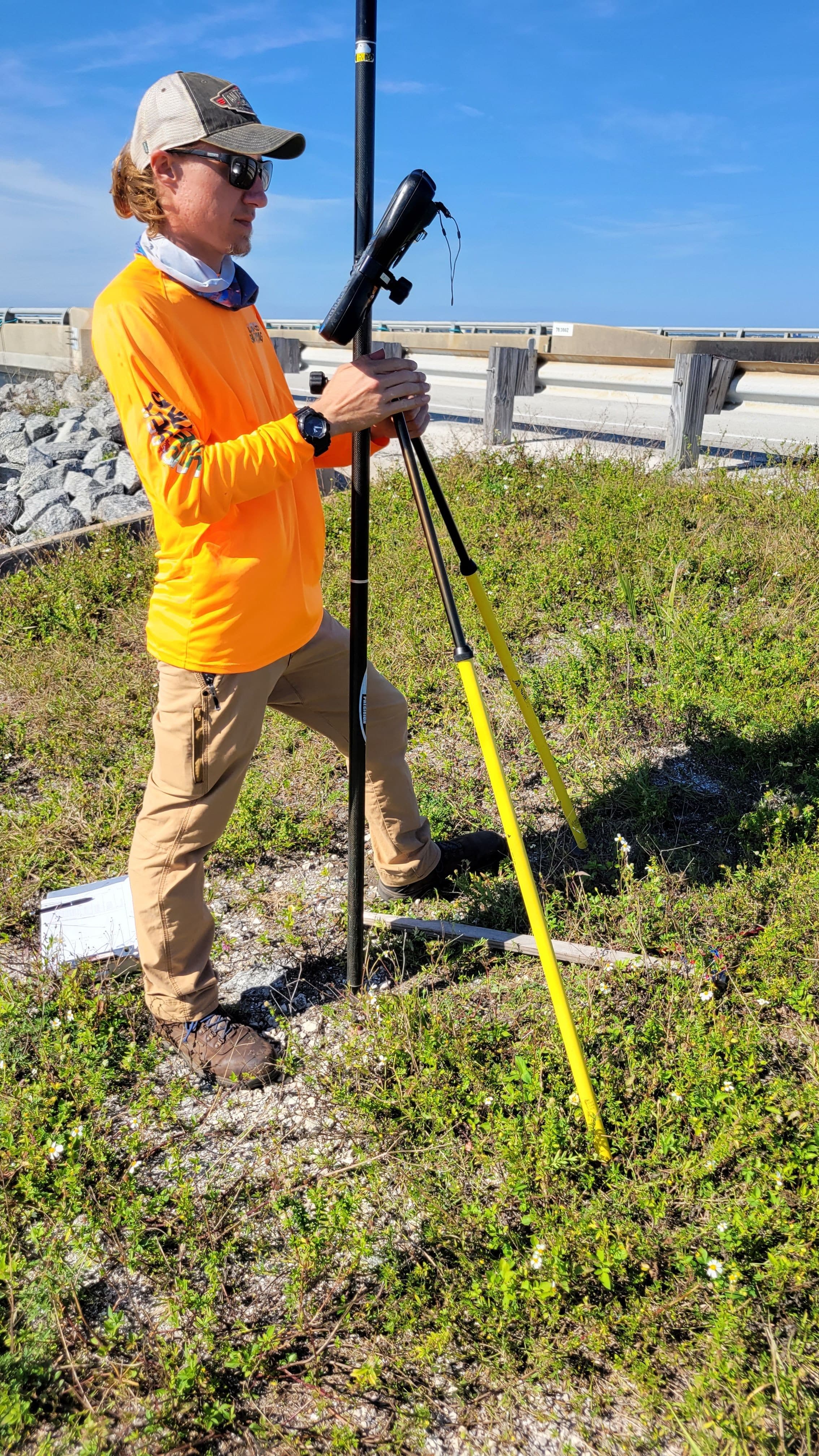
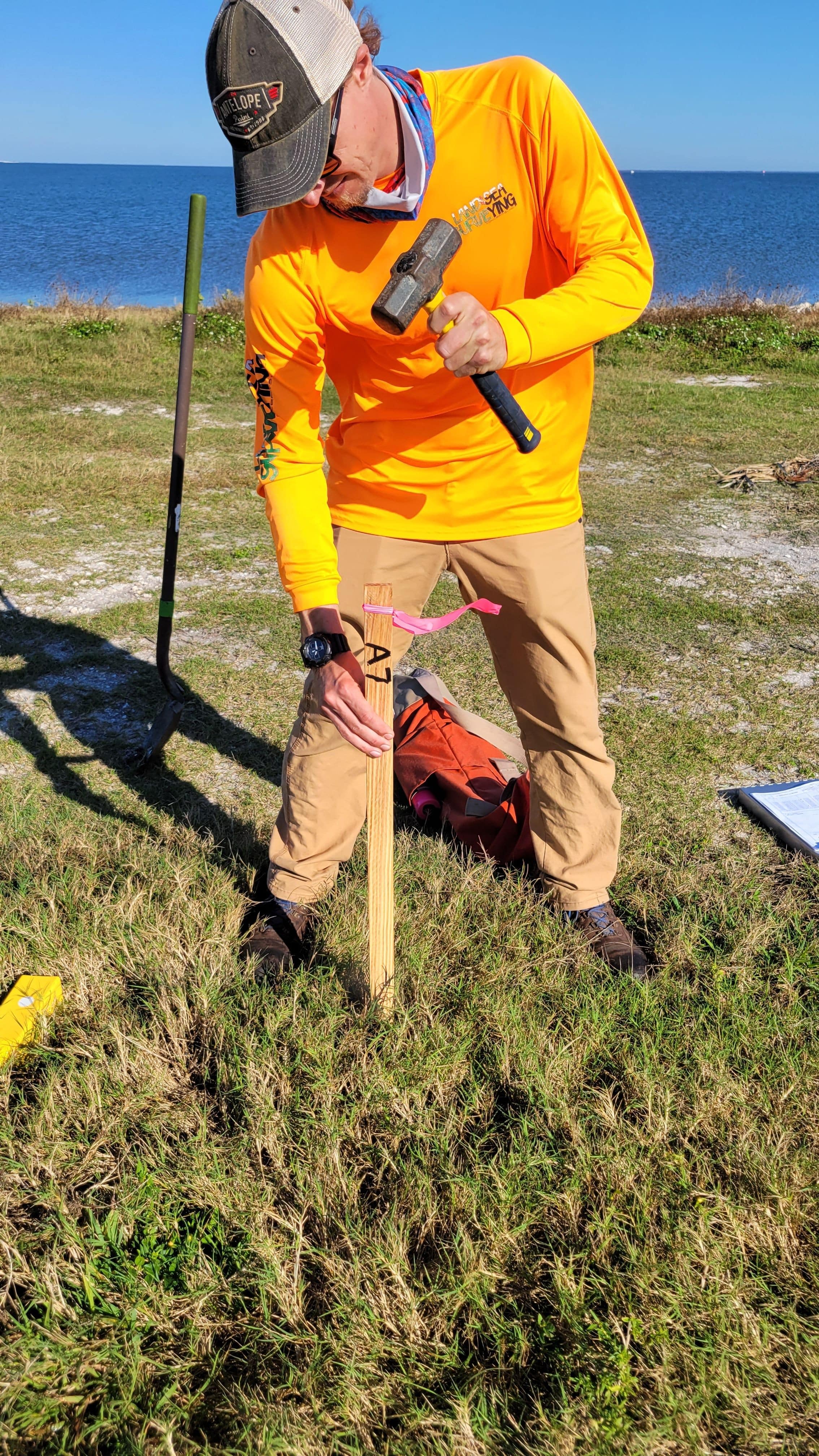
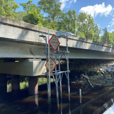
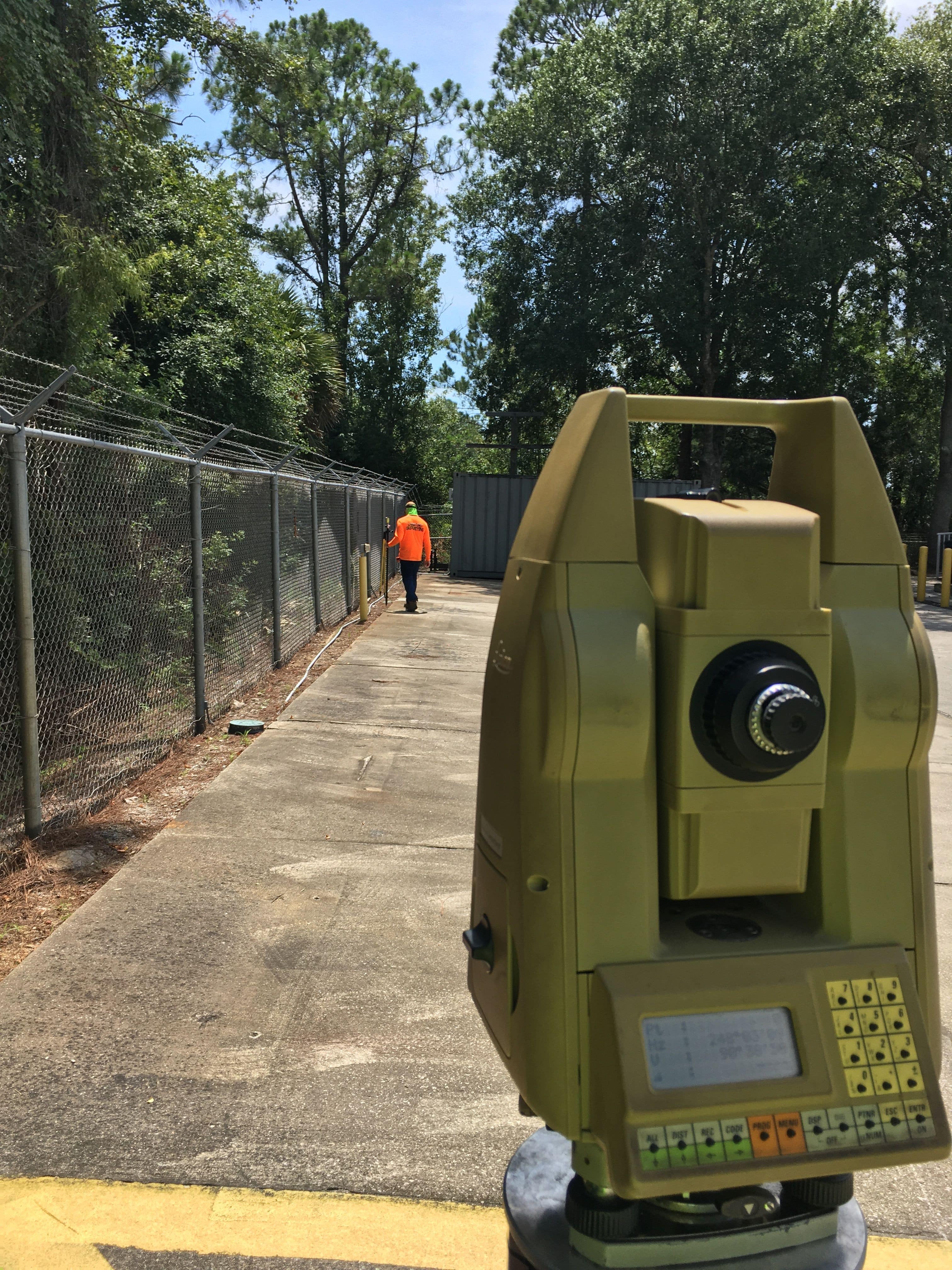
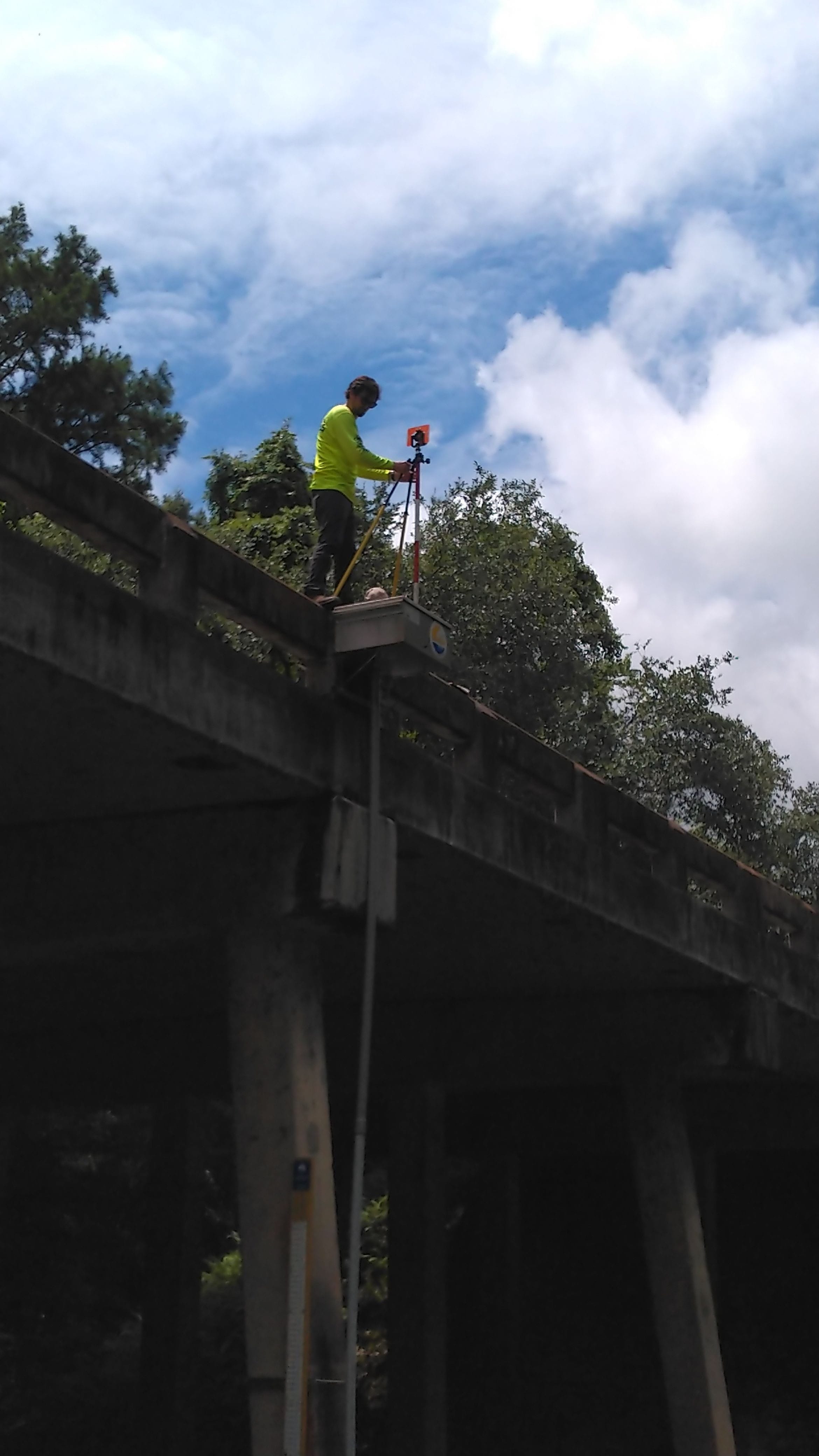
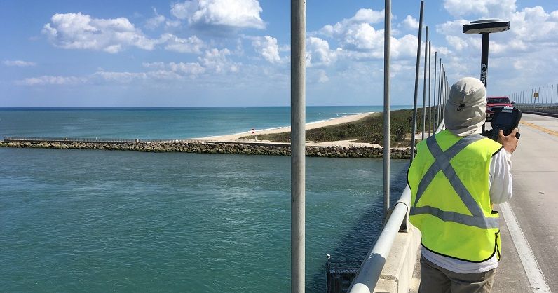
December 2021: NASA Causeway Bridge Replacement
Land & Sea Surveying provided surveying servises in support of the NASA Causeway Bridge Replacement Project


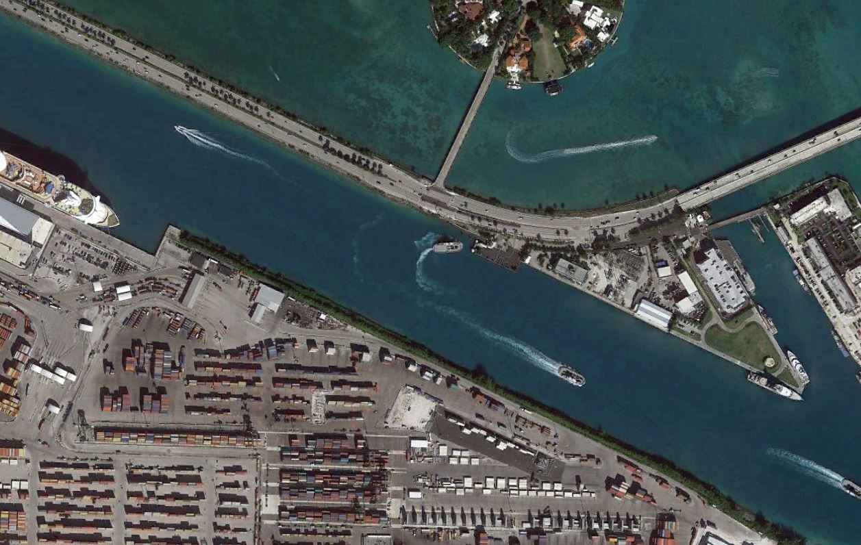
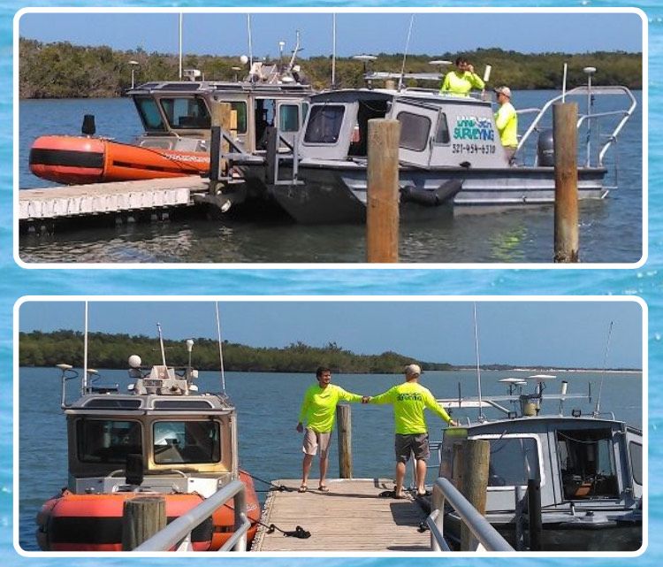
December 2021: Berths 8 and 9 at Port Miami
Land & Sea Surveying provided hydrographic surveying services
.JPG)
.JPG)
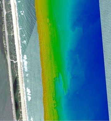
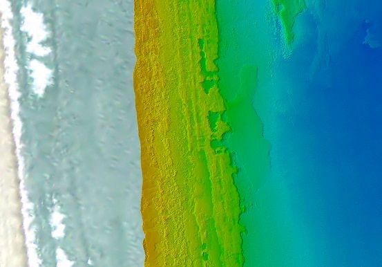
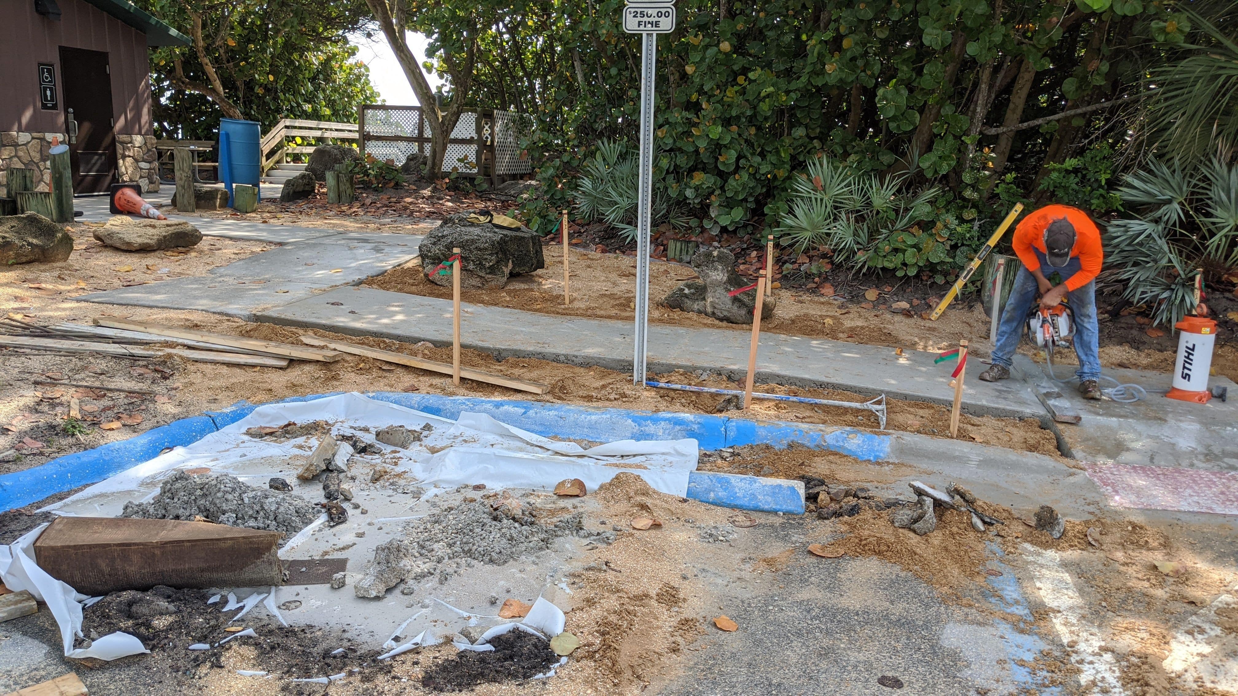
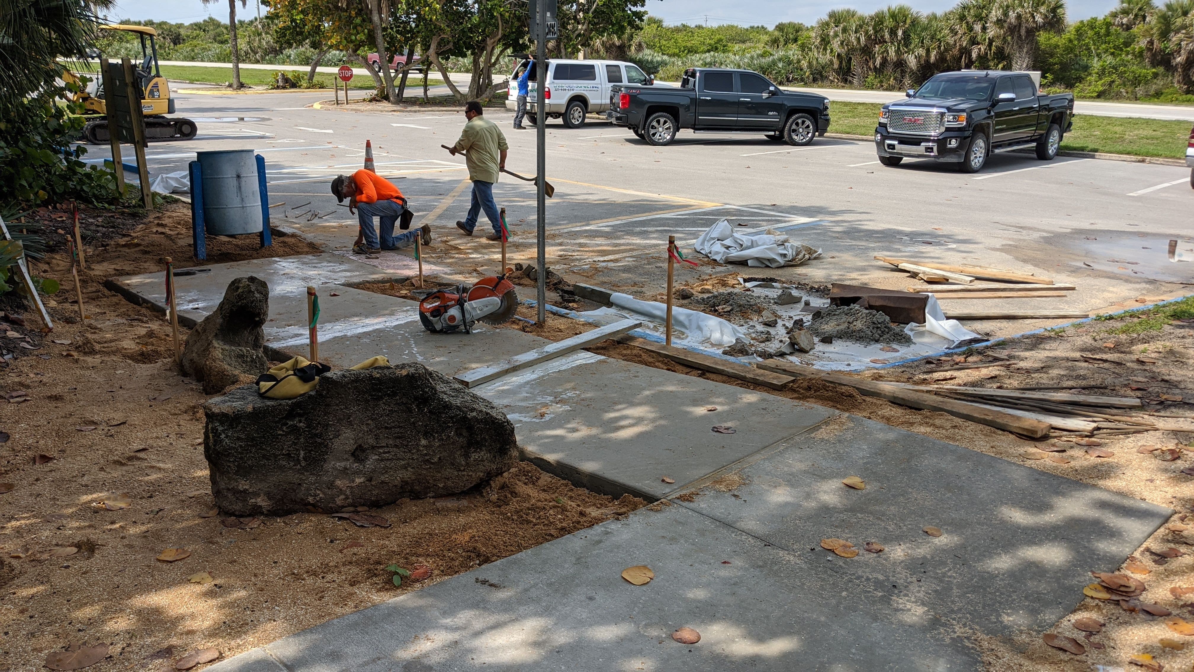
December 2021: Ft. Pierce Inlet State Park
Land & Sea Surveying performed a survey of the formboards at Ft. Pierce Inlet State Park North Restrooms


.jpg)


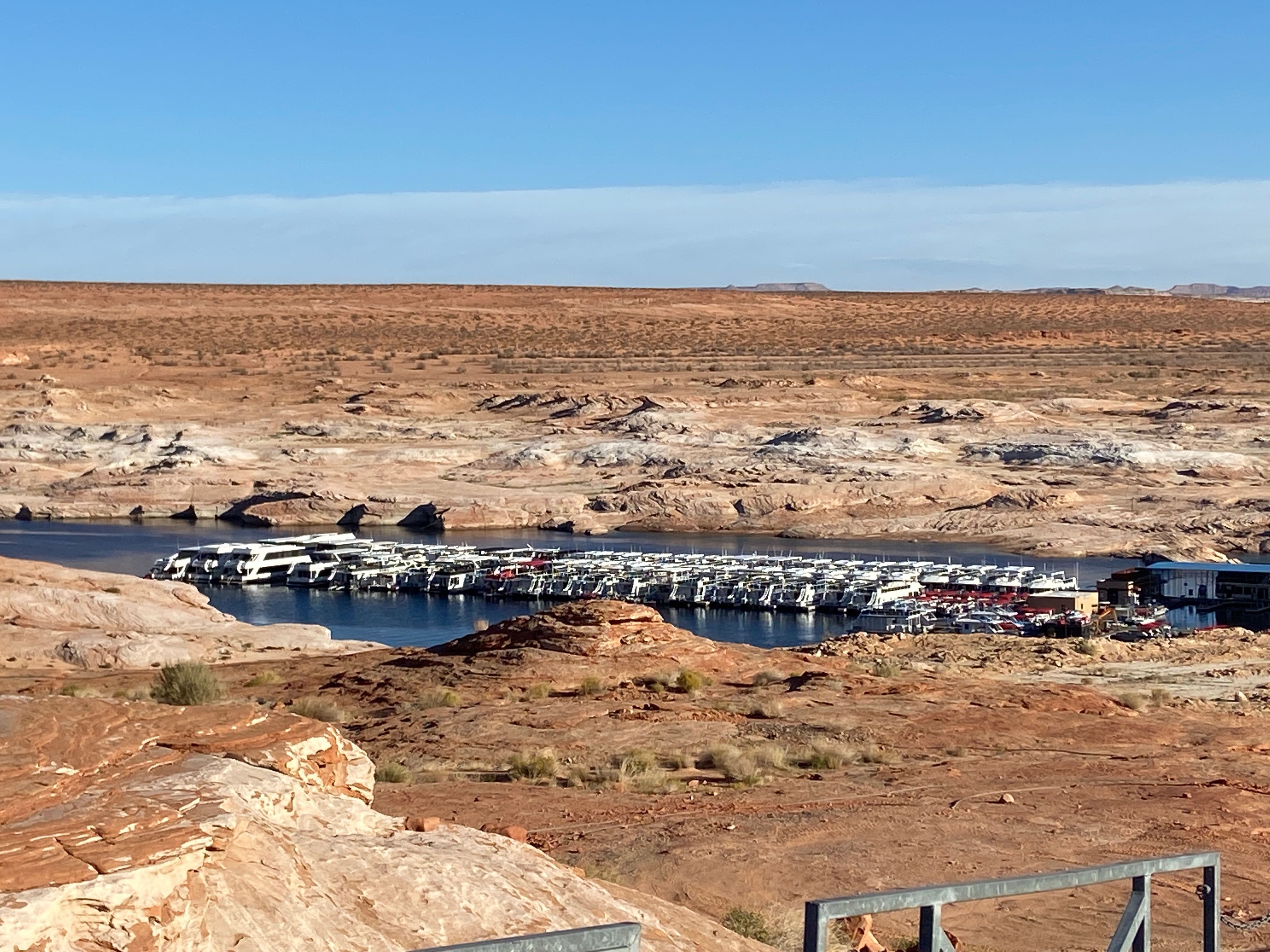
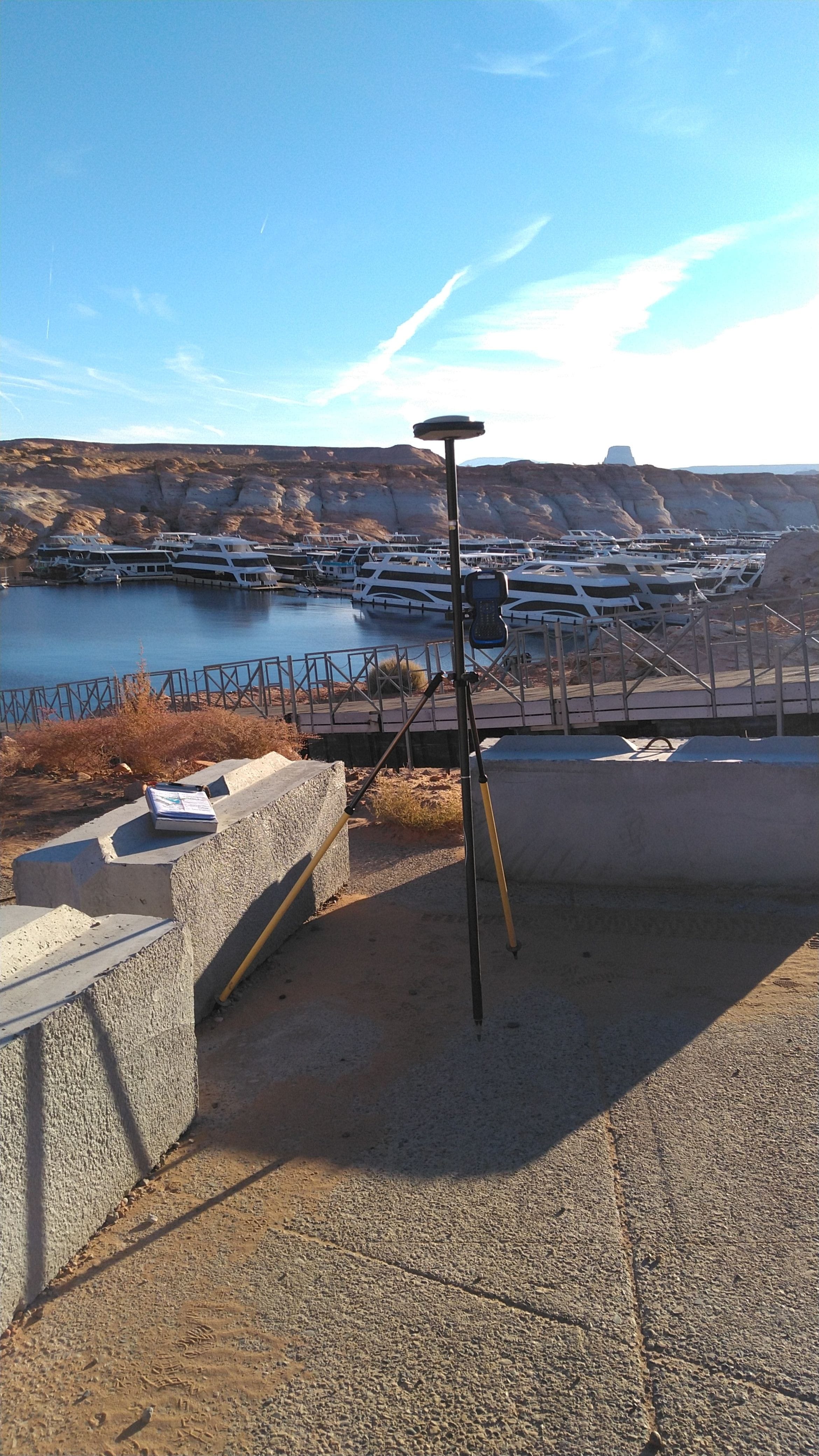
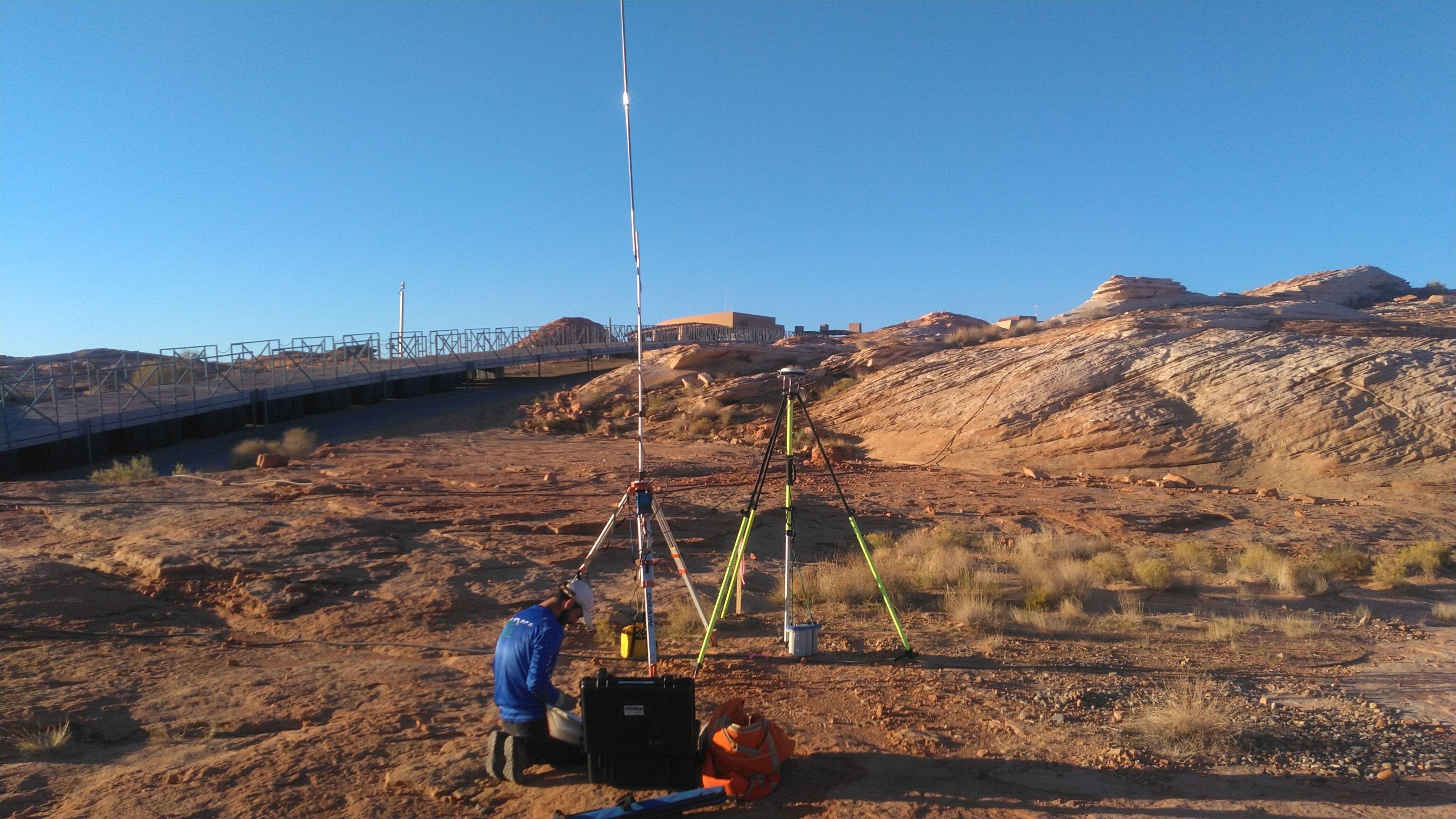
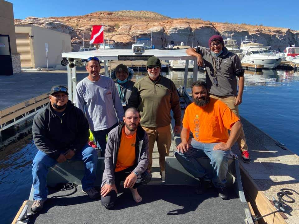
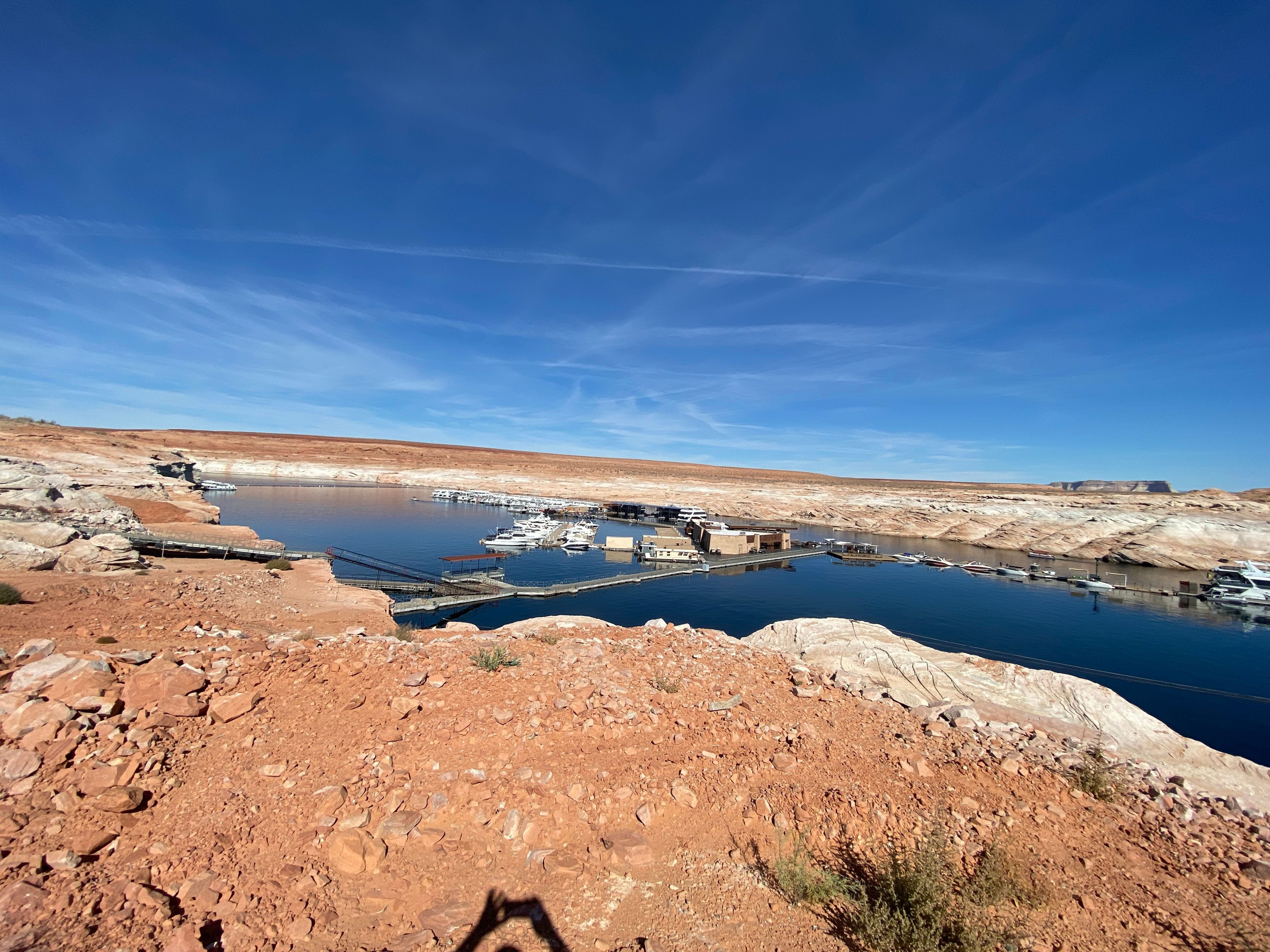
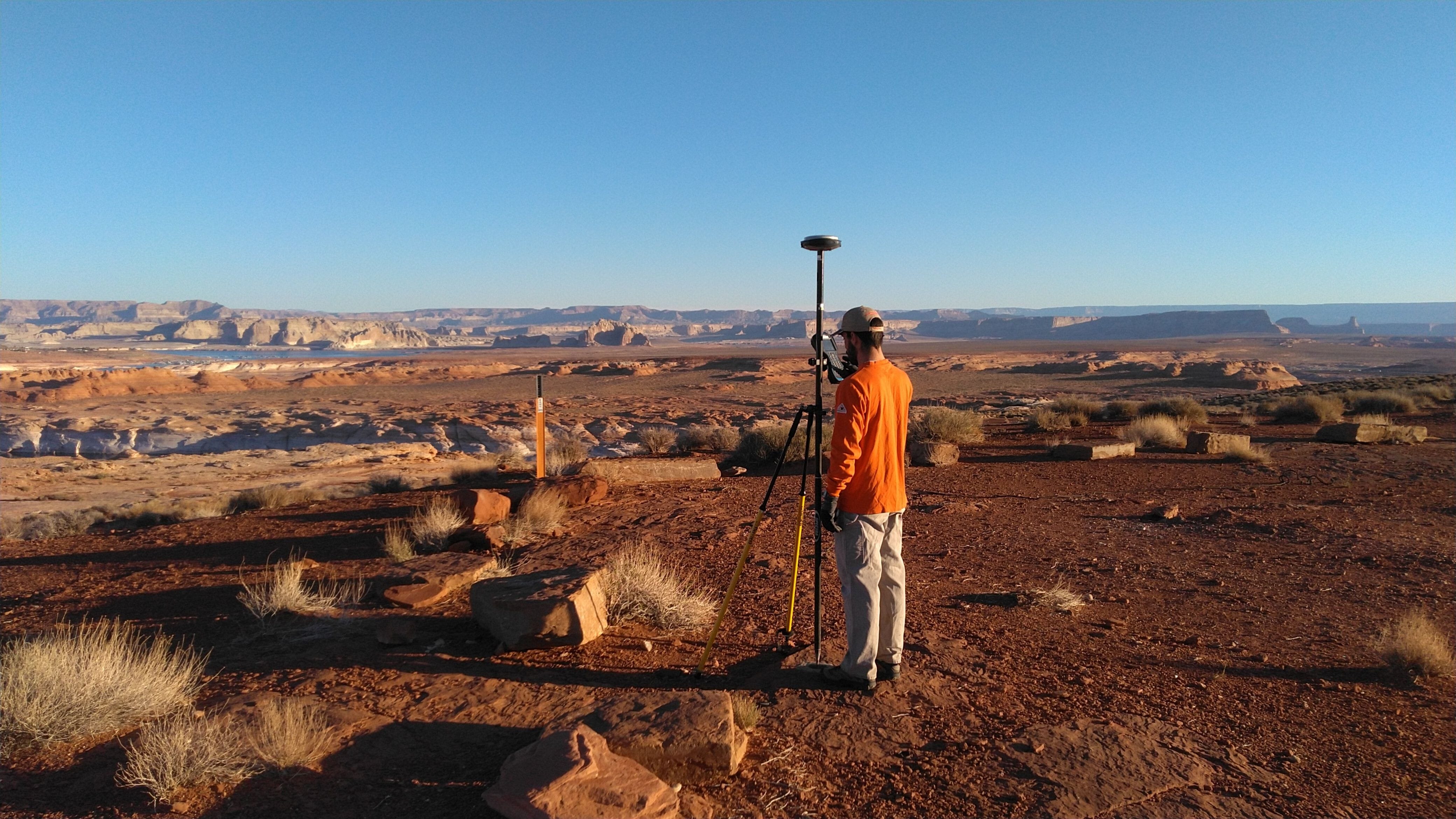
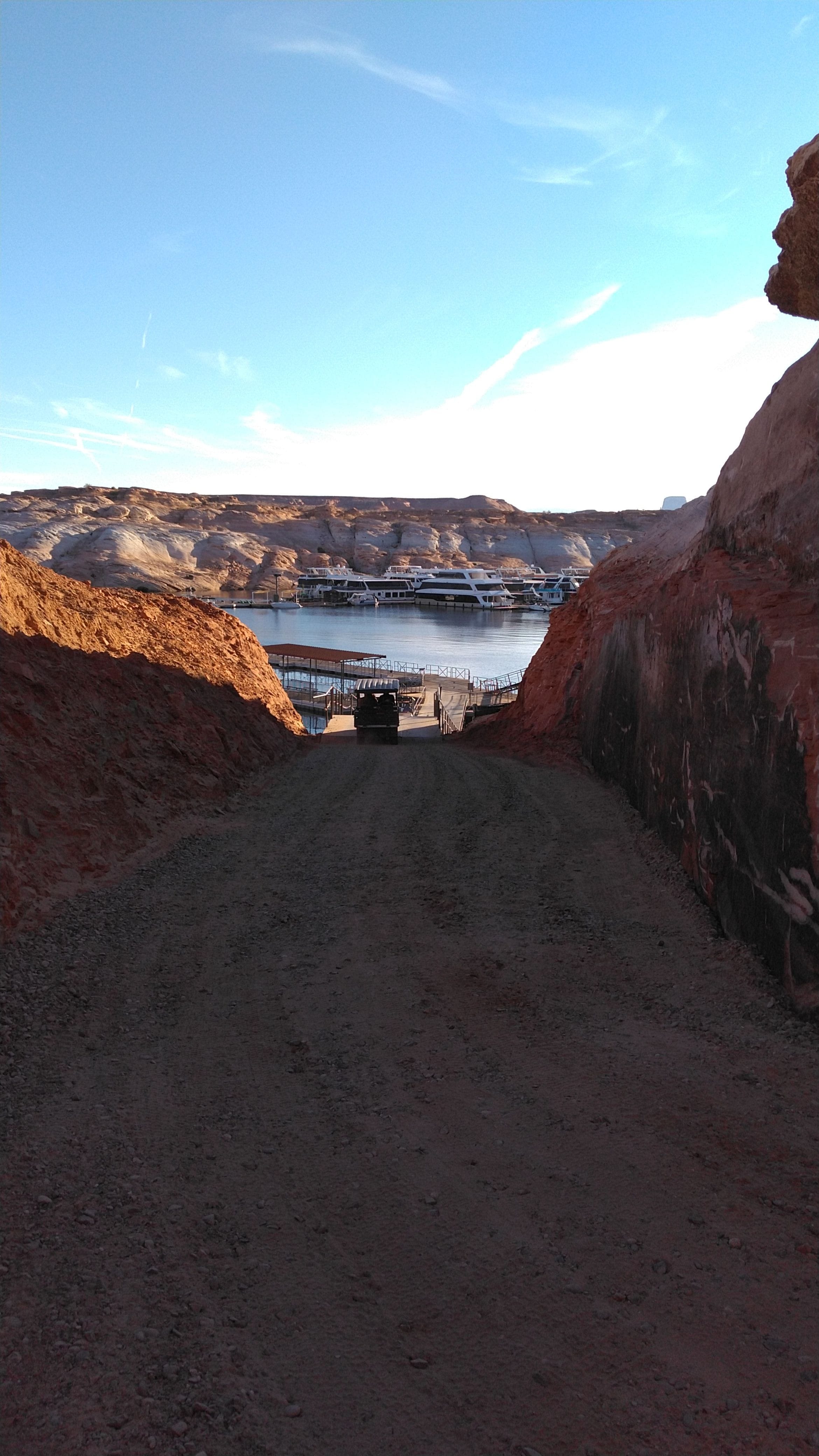
November 2021: National Parks Service Contract Lake Powell
Land & Sea Surveying performed a survey and dive inspection of the docks at the Antelope Point Marina in Lake Powell, AZ.


.JPG)
.JPG)


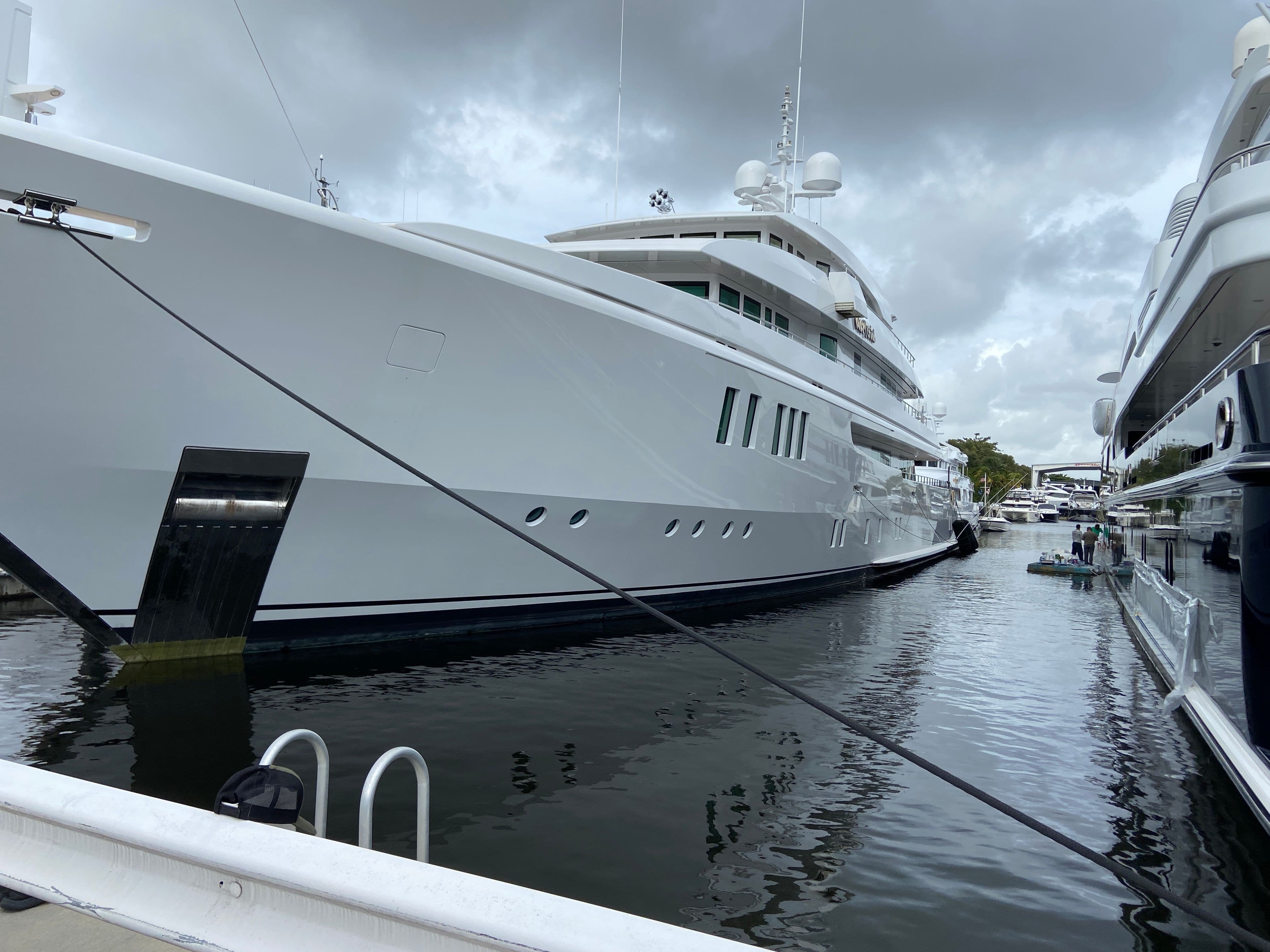
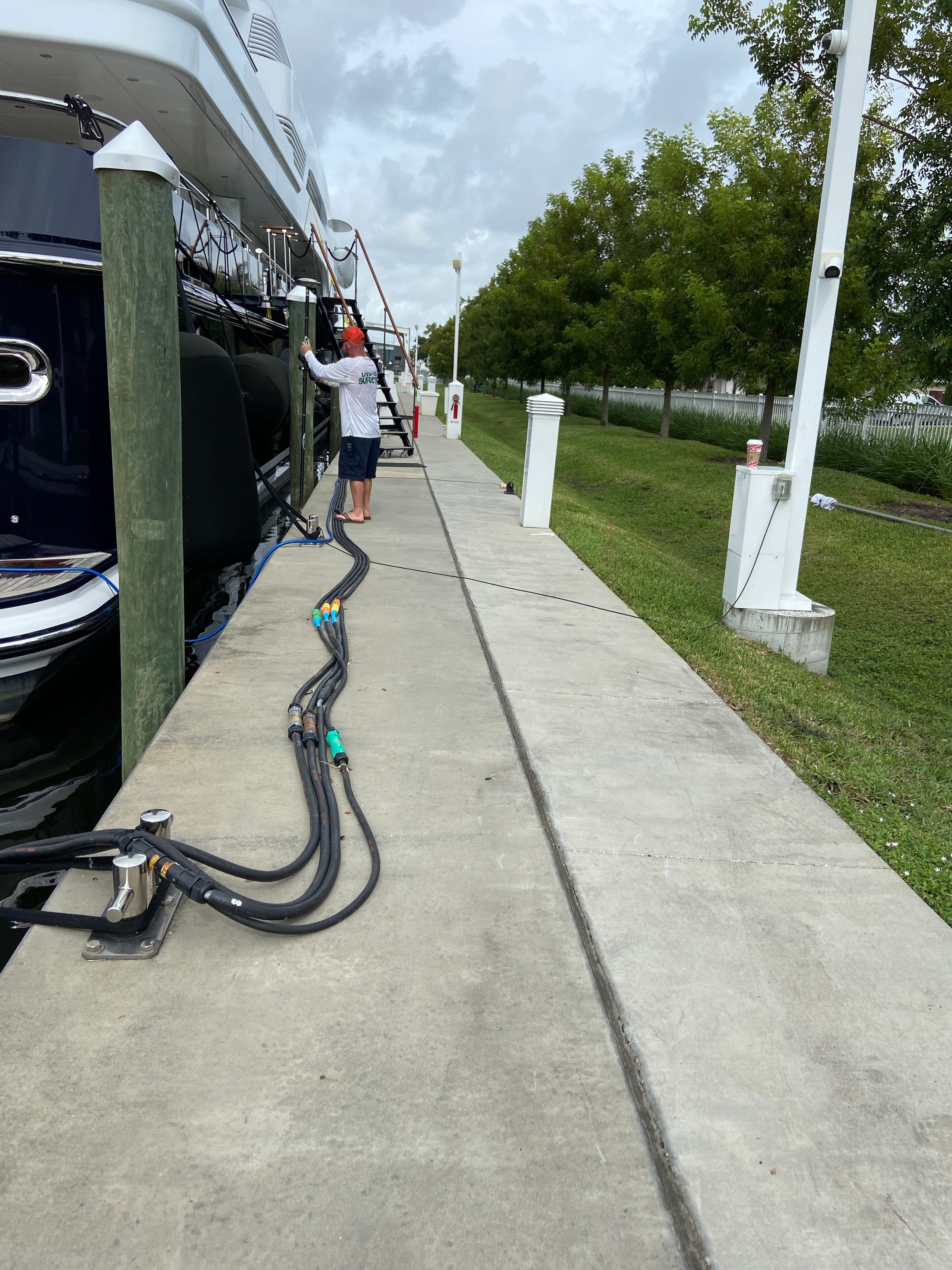
November 2021: Hydrographic Survey of Suntex Marinas
Land & Sea Surveying provided a hydrographic survey of the marina basins at Garrison Bight Marina in Key West and Cozy Cove Marina and Seahaven Superyacht Marina in Dania Beach

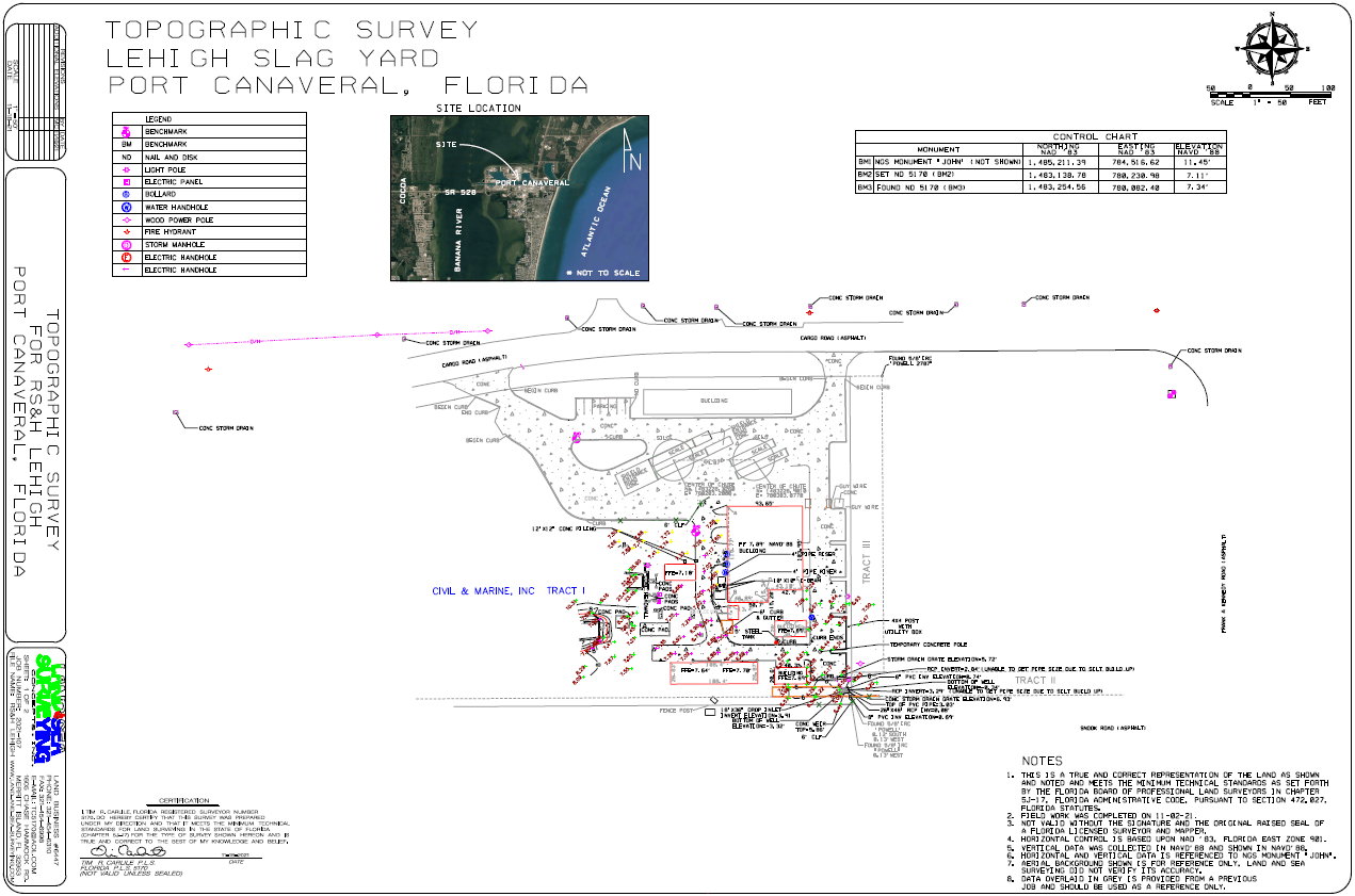
November 2021: Lehigh Slag Processing Plant at Port Canaveral, FL
Land & Sea Surveying performed a topographic survey of the Lehigh Slag Processing Facility in Port Canaveral, FL.


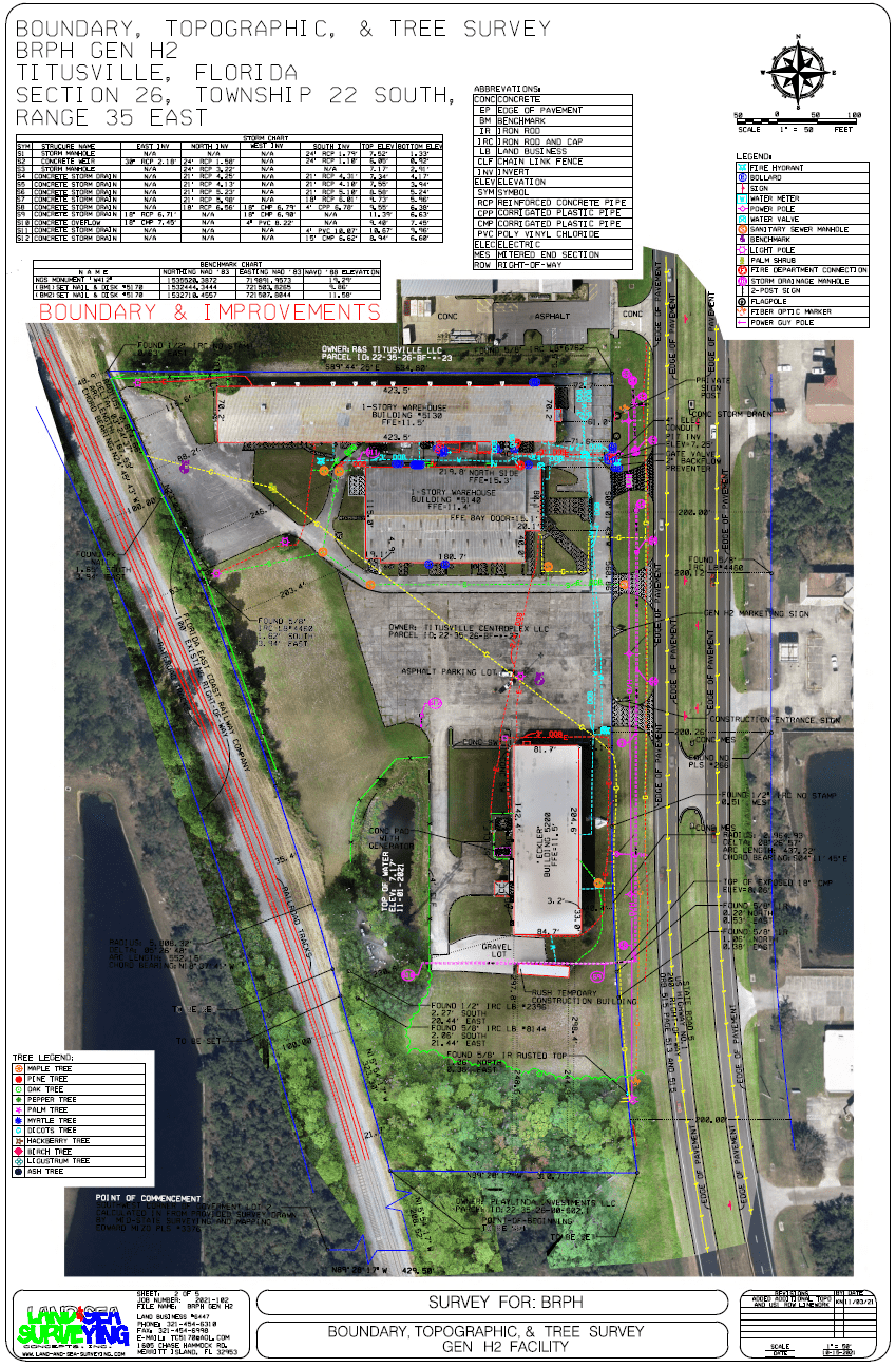
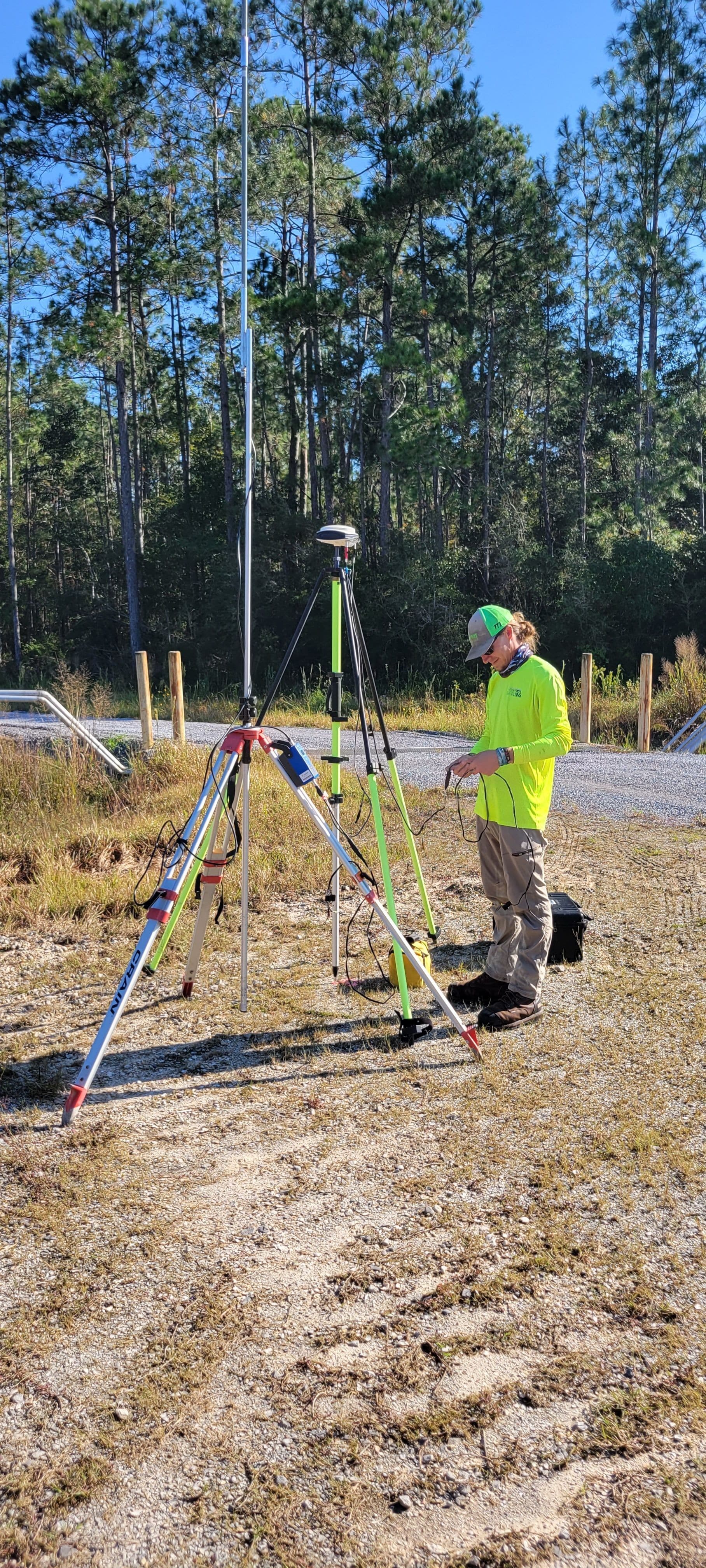
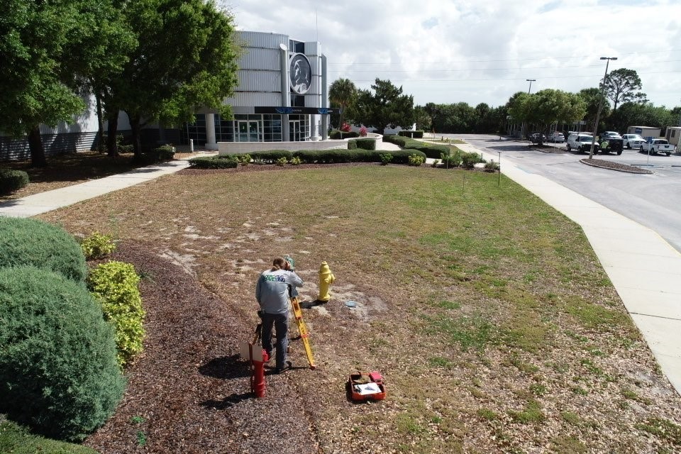
November 2021: GEN H2 Boundary and Topo
Land & Sea Surveying performed a boundary, topographic, tree count, and aerial drone survey of a site to be developed in Titusville, FL.

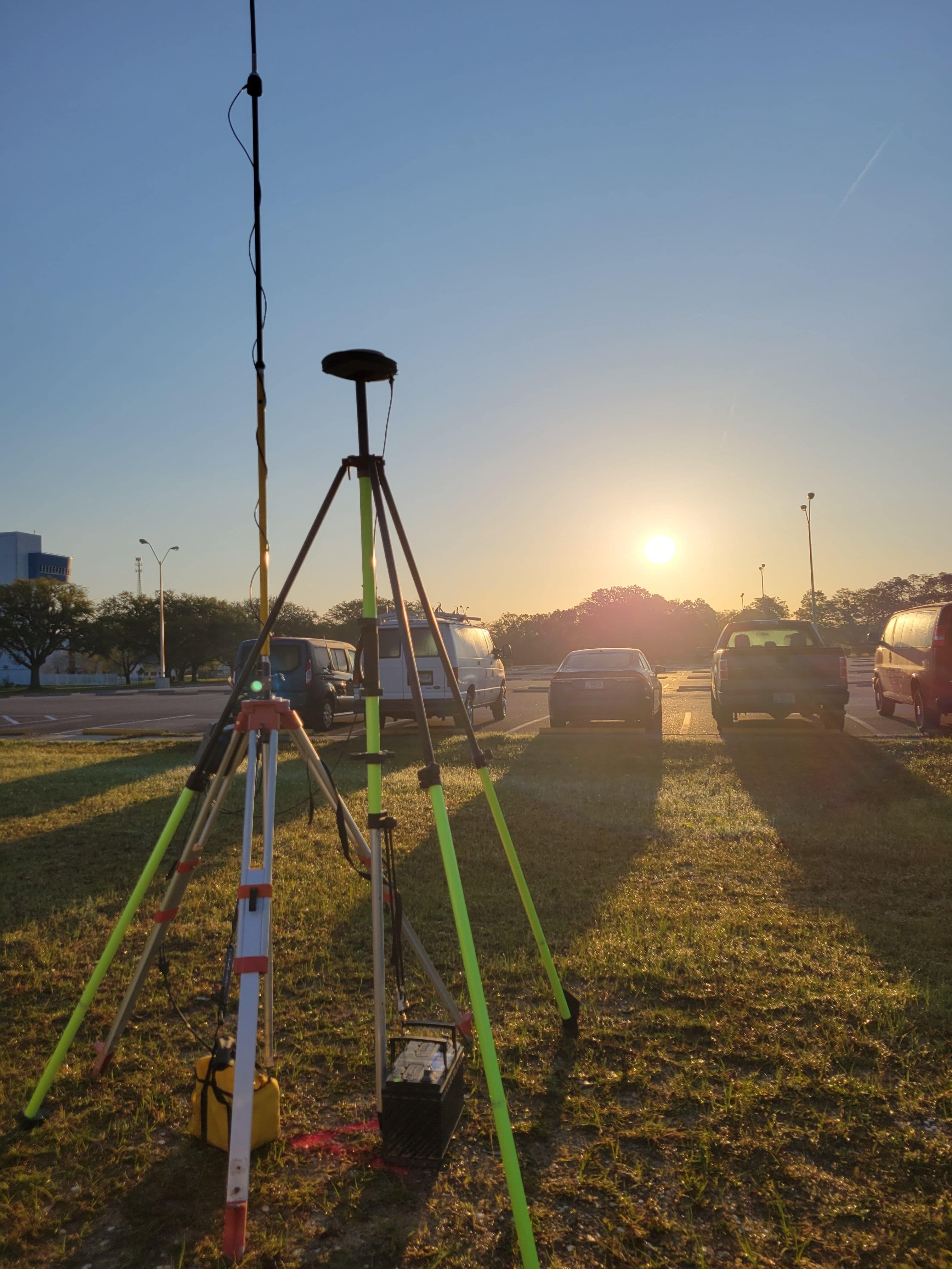
October 2021: Stennis Space Center
Land & Sea Surveying performed a topographic survey at two sites at the Stennis Space Center in Mississippi.


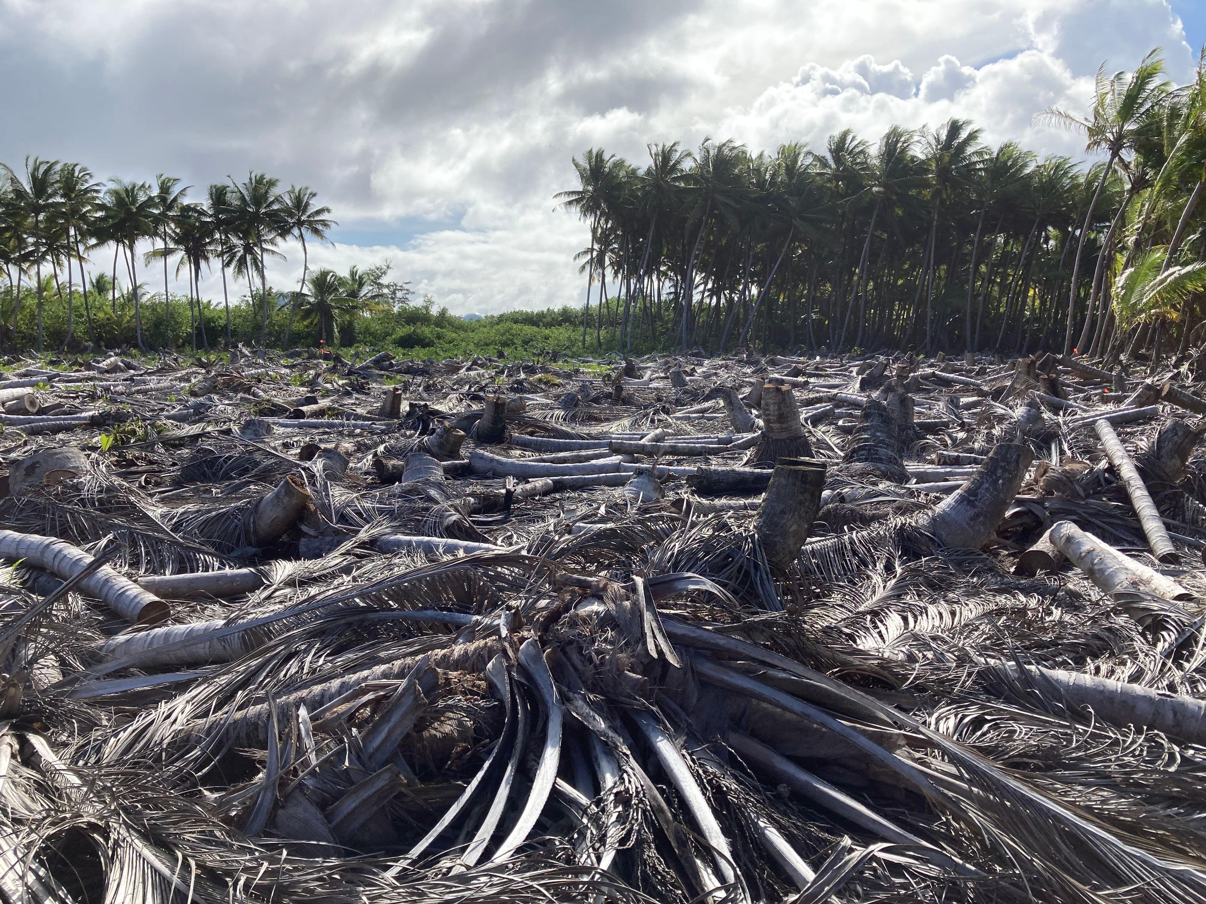
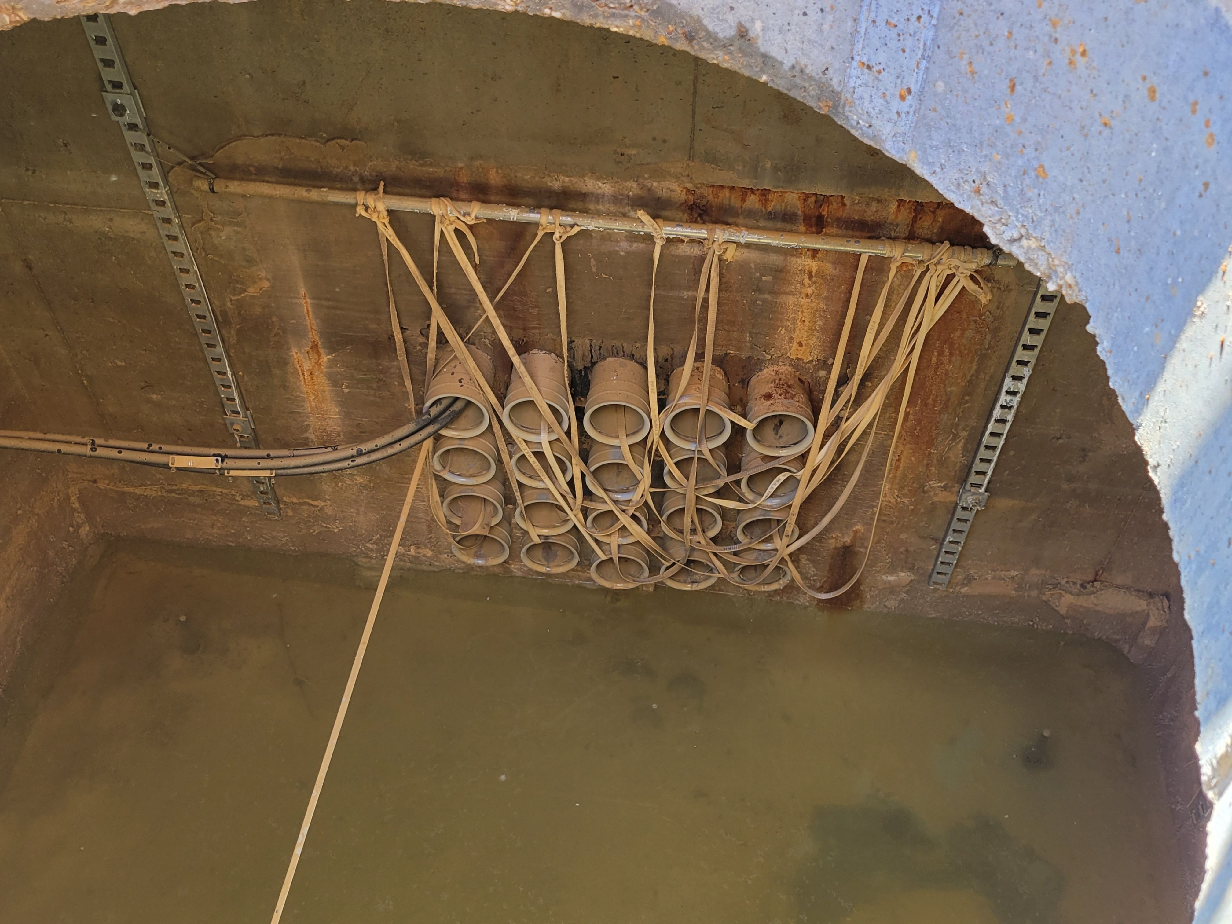
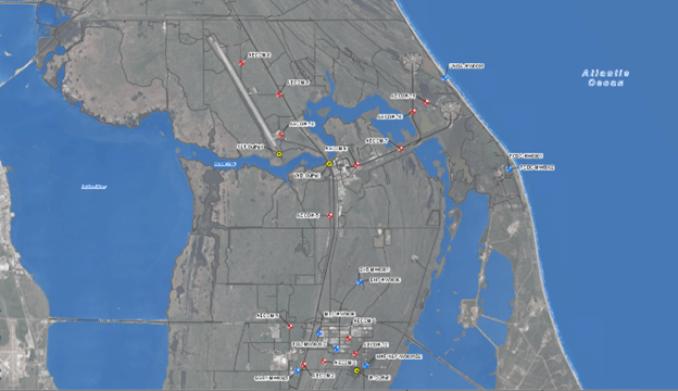
September 2021: Diego Garcia
Land & Sea Surveying performed a topographic and underground utility locate survey on the island of Diego Garcia in the Brittish Indian Ocean Territory.
.JPG)

.JPG)

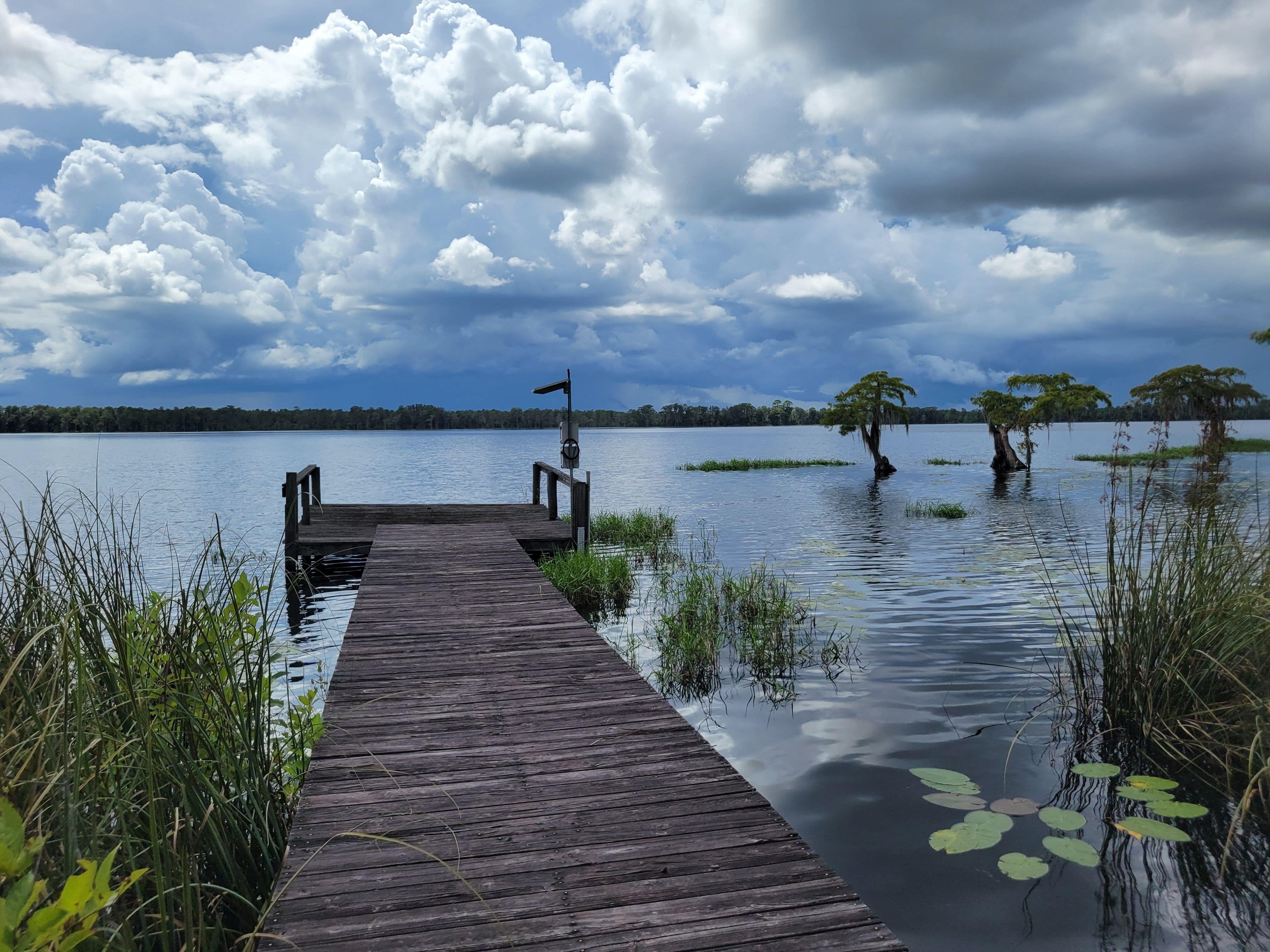
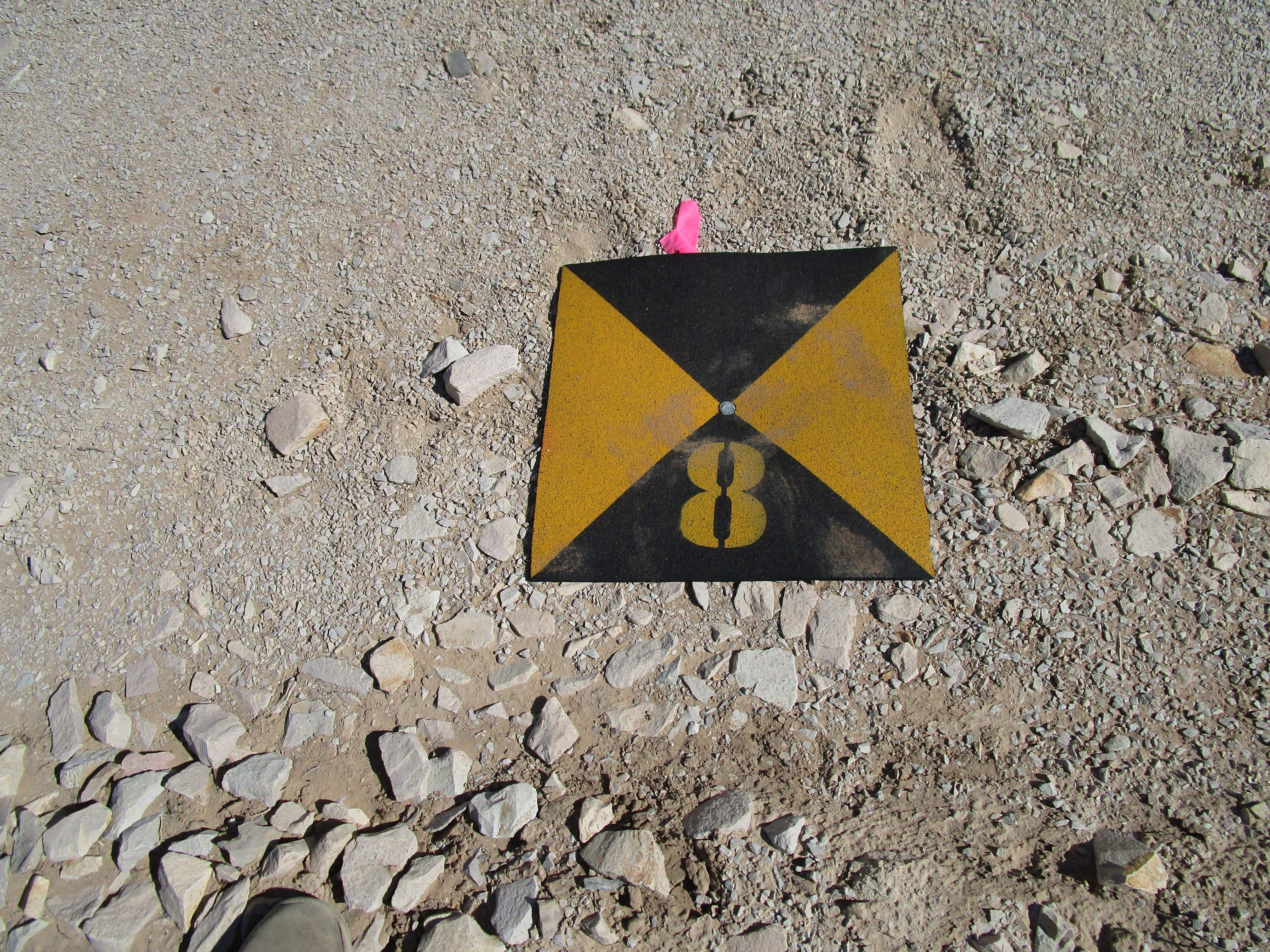
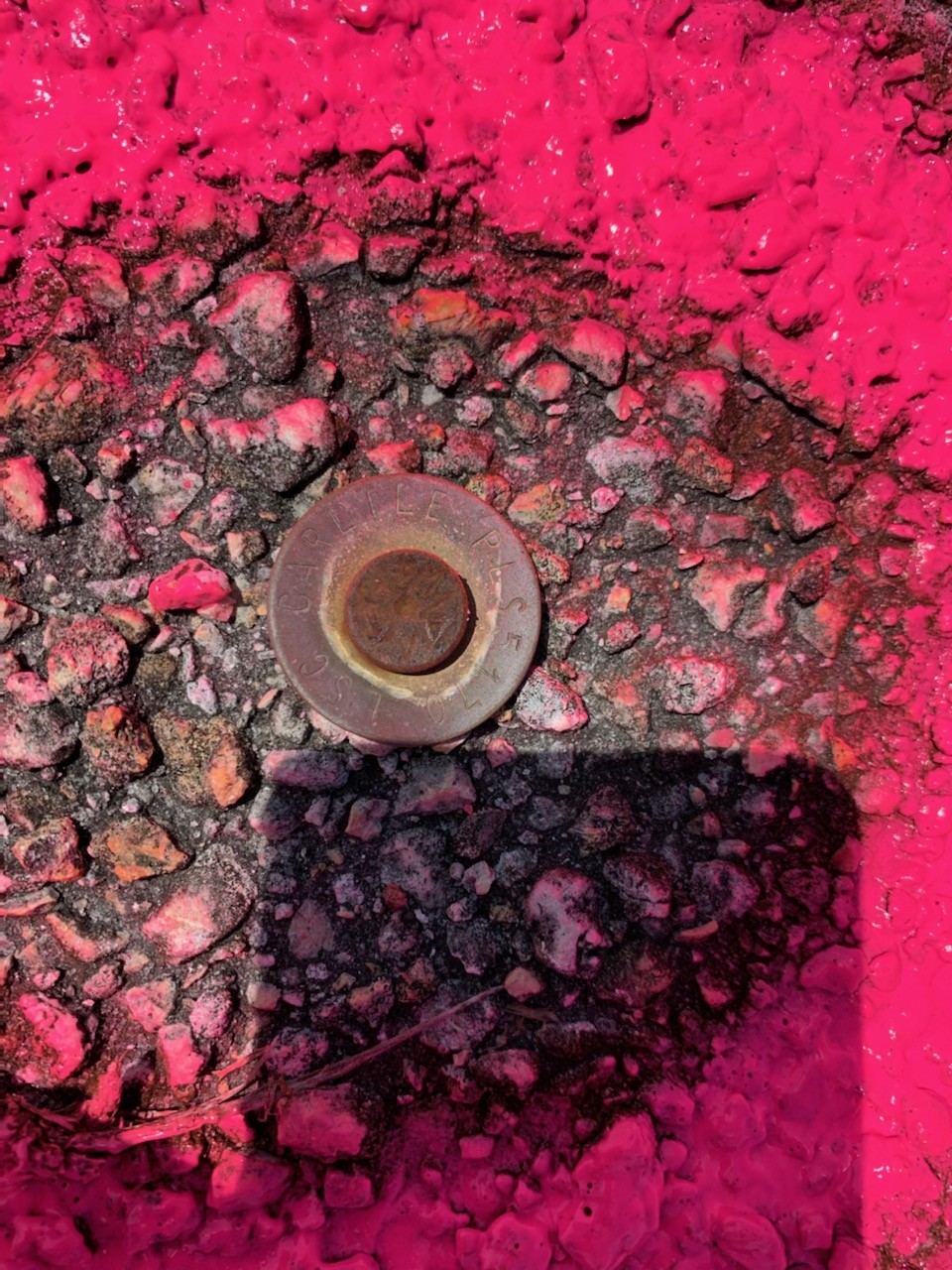
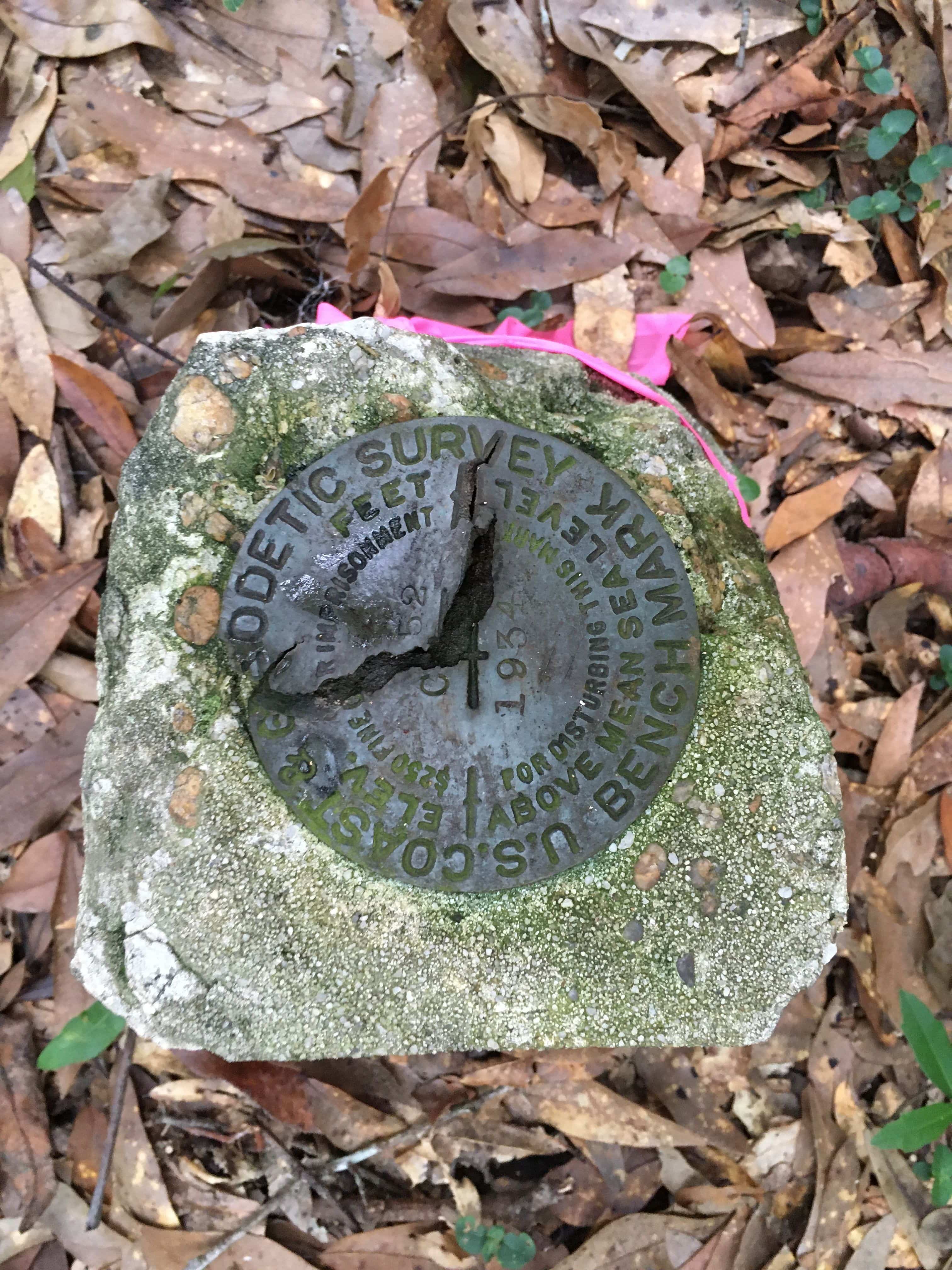
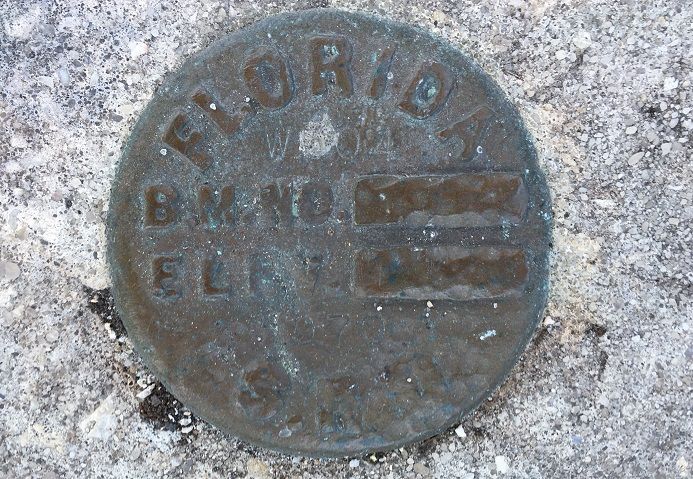
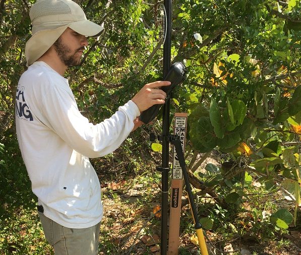
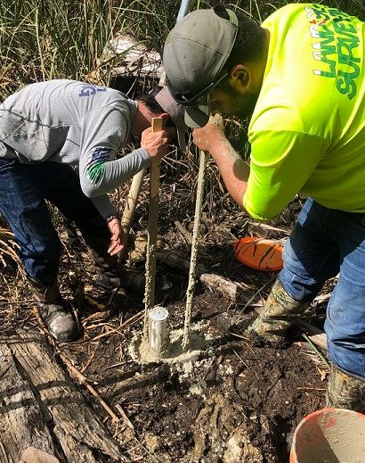
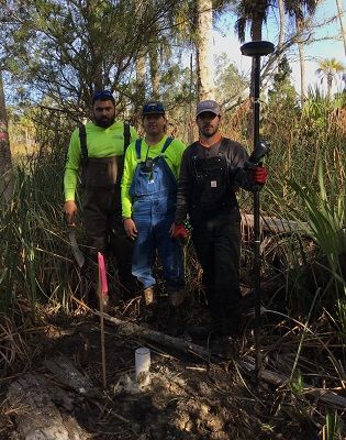
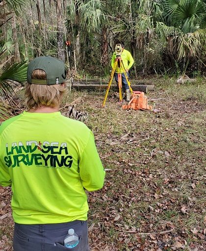
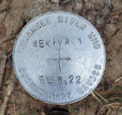
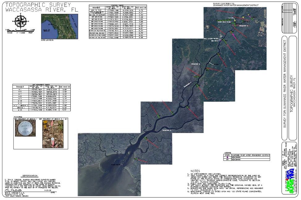
September 2021: Suwannee River Water Management Benchmark Surveys
Land & Sea Surveying provided surveys for 18 gauge sites within the management district. Benchmarks were set and elevations were established on the gauges, measuring points, benchmarks, and reference points.
.jpg)
.JPG)
.jpg)
.jpg)
.jpg)
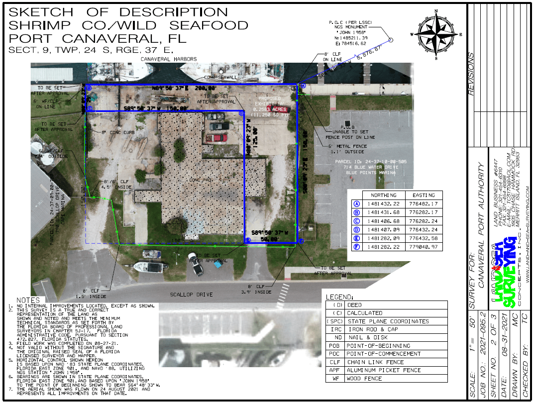
August 2021: Boundary and Legal Descriptions for Canaveral Port Authority
Land & Sea Surveying performed boundary surveys and prepared legal descriptions for five lease parcels at Port Canaveral in FL. An aerial drone was also flown and current aerial images were collected of the sites. An orthomosaic image was created for the sites.
.png)
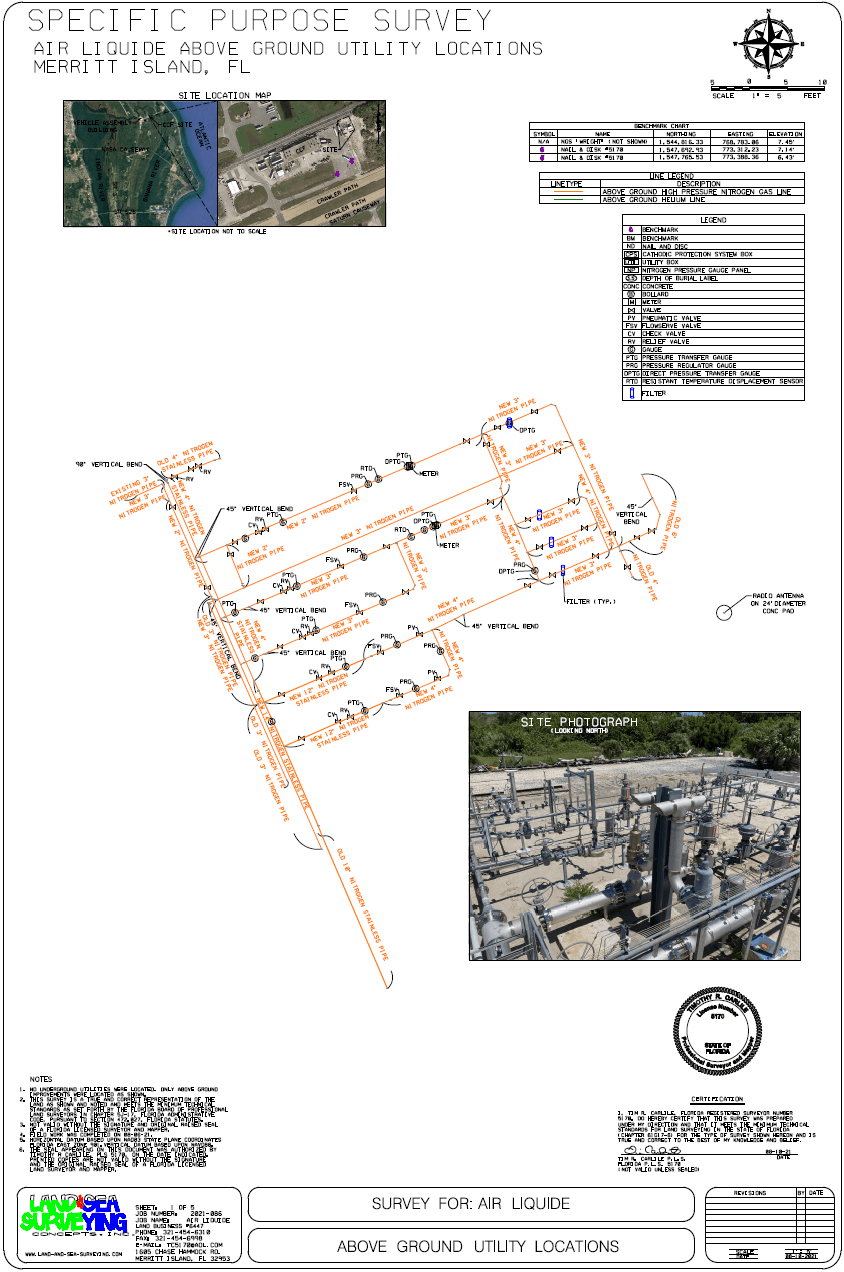
August 2021: Converter Compressor Facility As-Built
Land & Sea Surveying performed an as-built survey of liquid nitrogen pipes and valves at a converter compressor facility for Air Liquide in Merritt Island, FL.

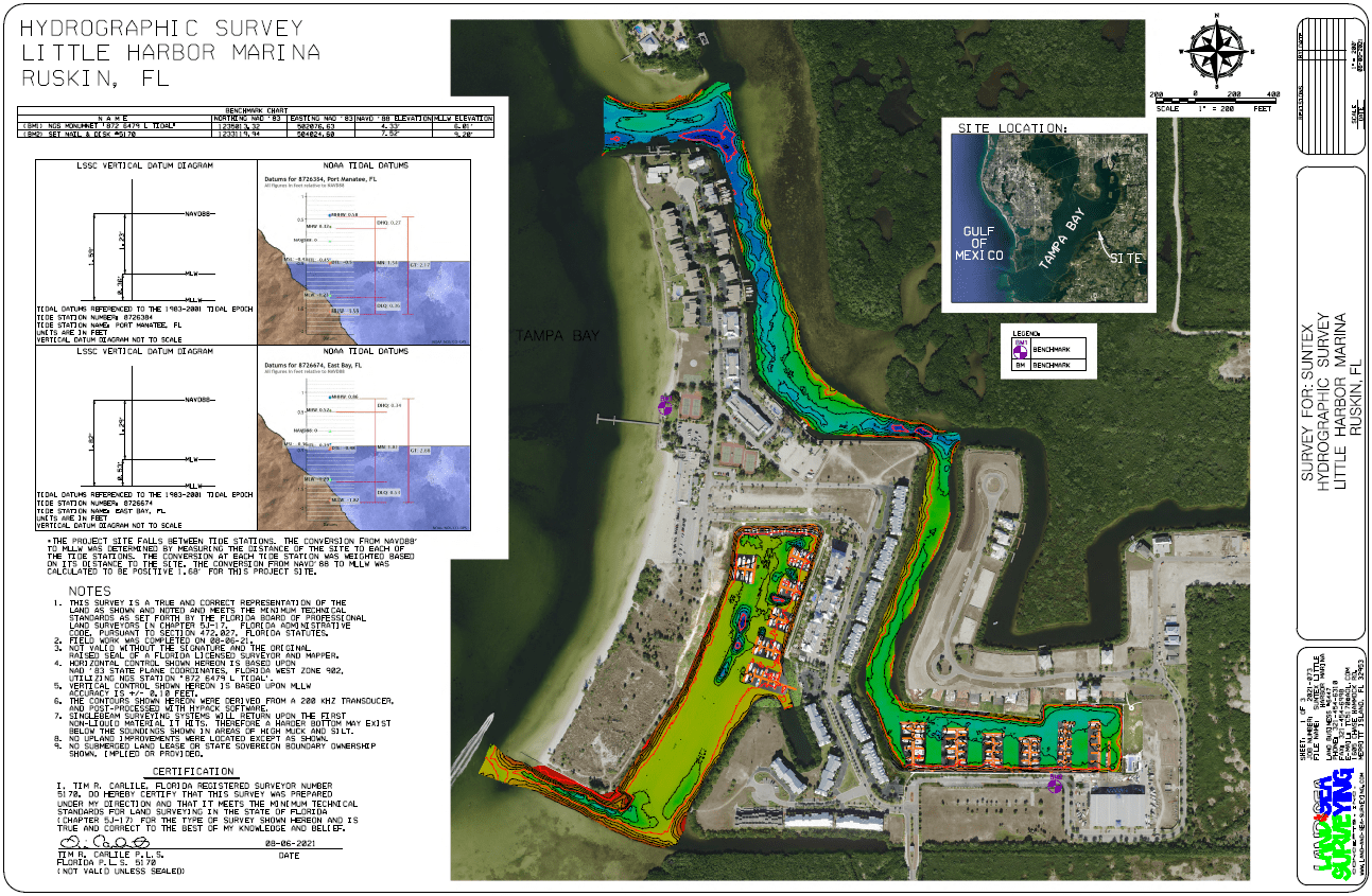
August 2021: Little Harbor Marina
Land & Sea Surveying performed a singlebeam hydrographic survey of the Little Harbor Marina in Ruskin, FL.
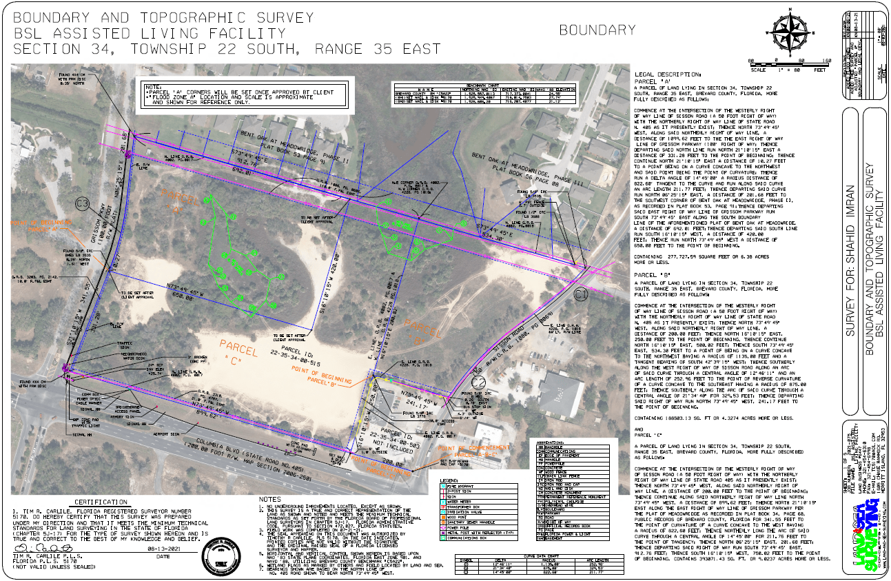
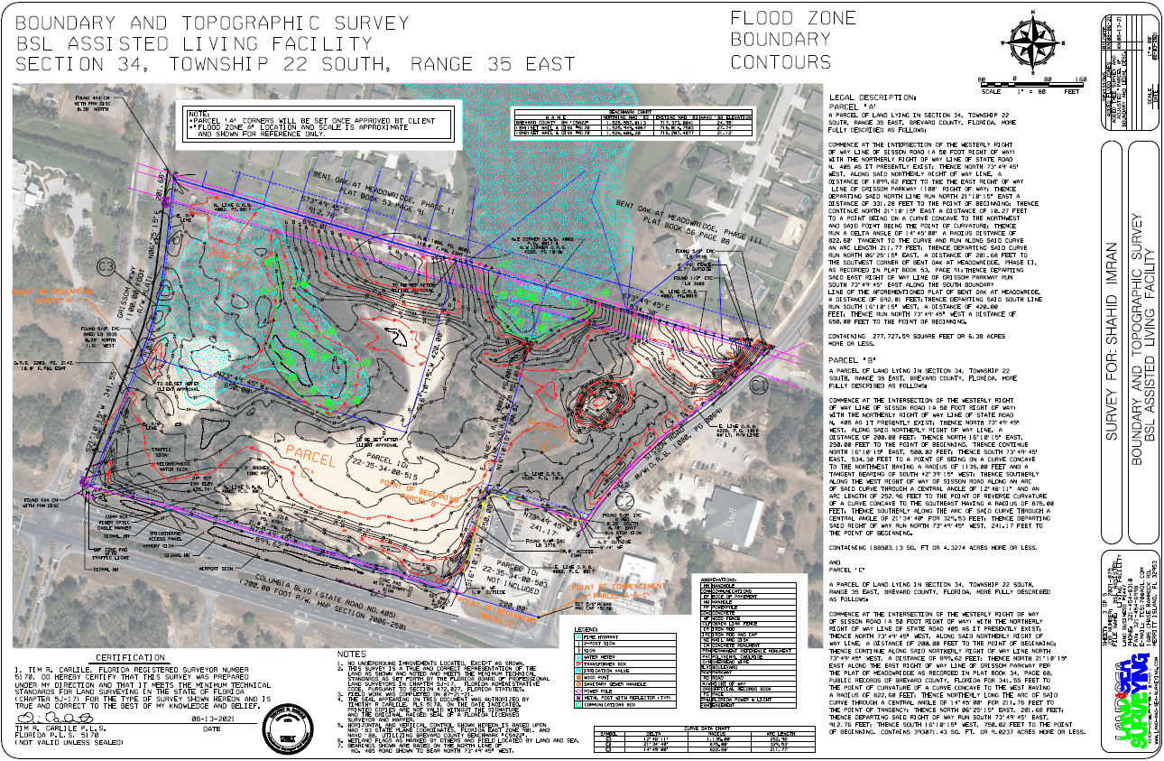
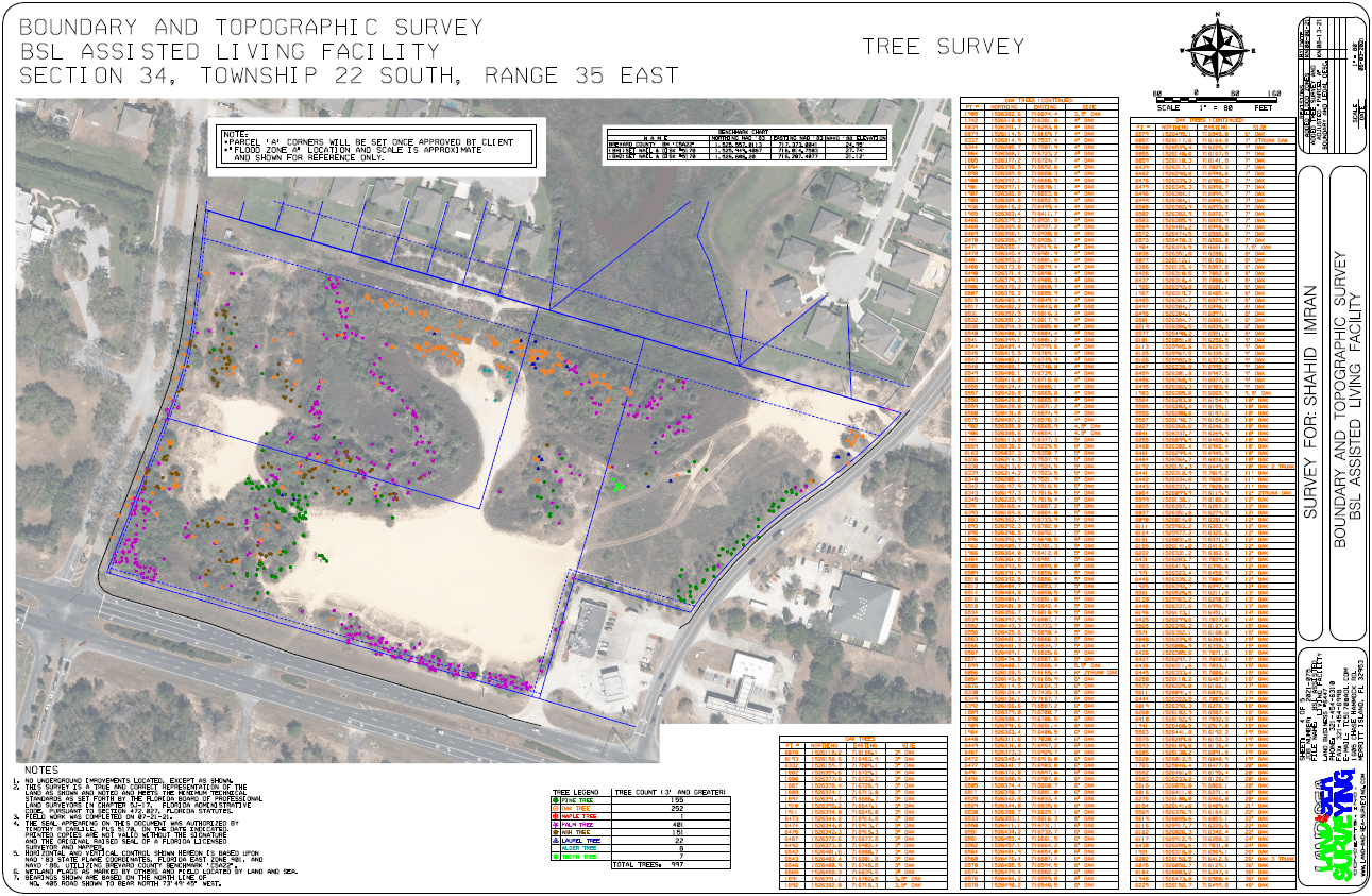
August 2021: BSL Assisted Senior Living Facility
Land & Sea Surveying performed a boundary, topographic, and tree count survey for a senior living facility in Titusville, FL.
July 2021: Port Everglades Multibeam Survey
Land & Sea Surveying performed a hydrographic survey of an area offshore of Dania Beach, FL. The data was processed to determine bottom classifications as well as bathymetry.
.JPG)
July 2021: Space View Park
Land & Sea Surveying performed an as-built and aerial drone survey of the construction at Space View Park in Titusville, FL.

.JPG)

.JPG)
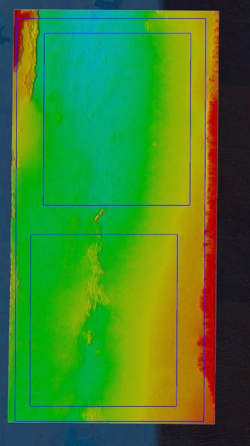
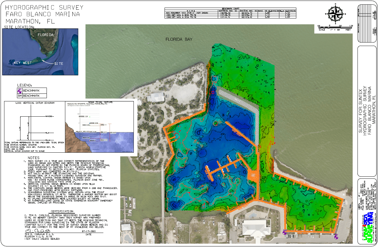
July 2021: Faro Blanco Marina
Land & Sea Surveying performed a singlebeam hydrographic survey of the Faro Blanco Marina in Marathon, FL.


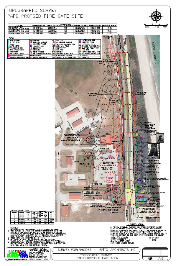
July 2021: CCSFS Fire Station Access Drive
Land & Sea Surveying provided a survey for the redesign of the fire station access driveway at Cape Canaveral Space Force Station as part of the TRACES contract
.JPG)
.jpg)
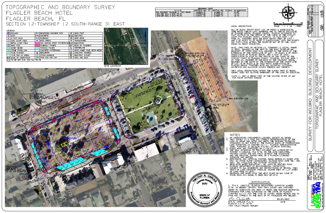
June 2021: Flagler Beach Hotel
Land & Sea Surveying provided a site survey and topographic survey of the project site


June 2021: Double Eagle Ranch Boundary
Land & Sea Surveying completed a boundary survey to split out 138 acres from parent tract and write a legal description for transfer.

.jpg)
.jpg)
.JPG)
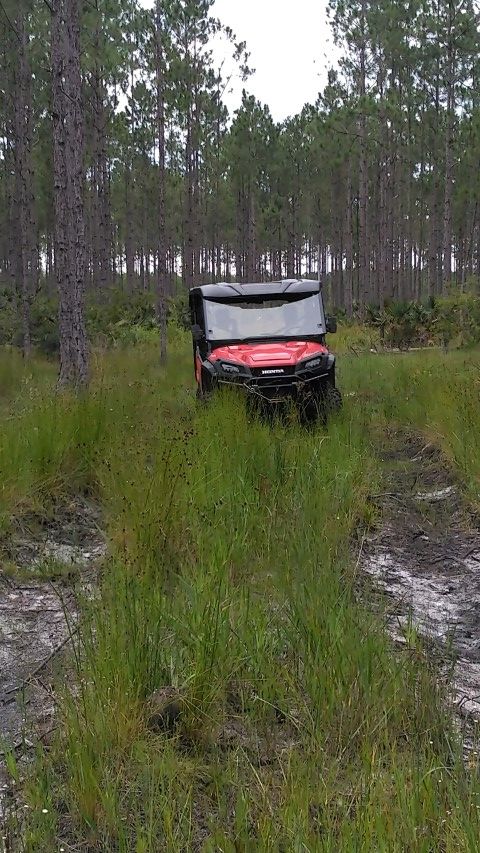
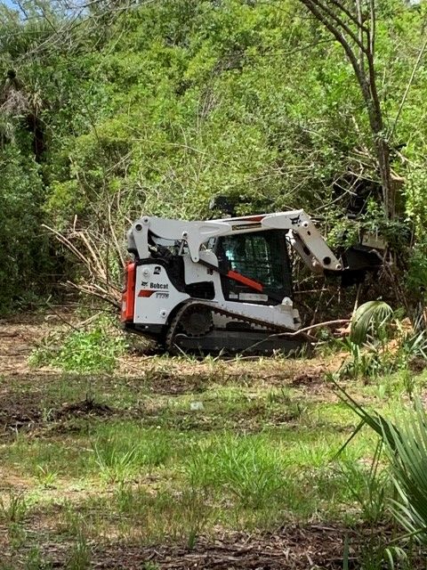
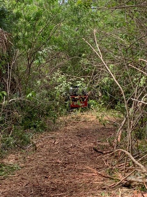
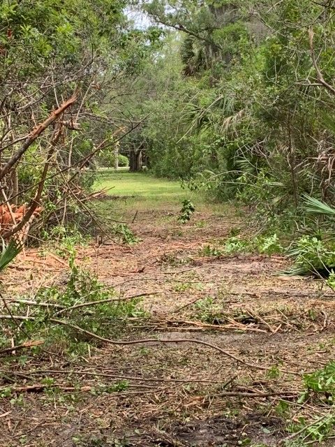
June 2021: Land Clearing on North Merritt Island
Land & Sea Surveying cleared perimeter of 3-acre parcel

.jpg)
June 2021: Lori Wilson Park, Cocoa Beach
Land & Sea Surveying provided topographic surveys of both the north and south parks for renovation design.
.JPG)

.JPG)
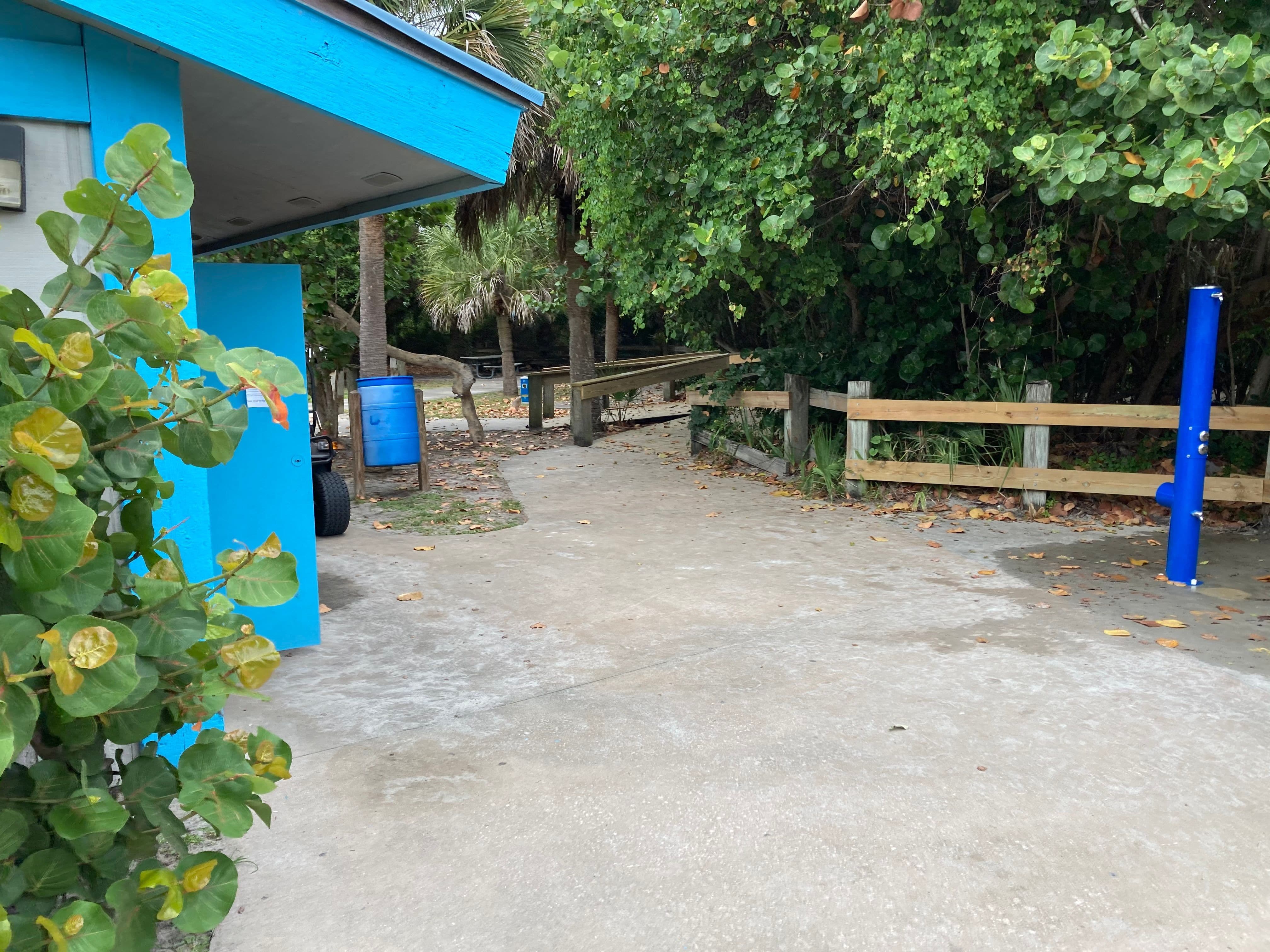
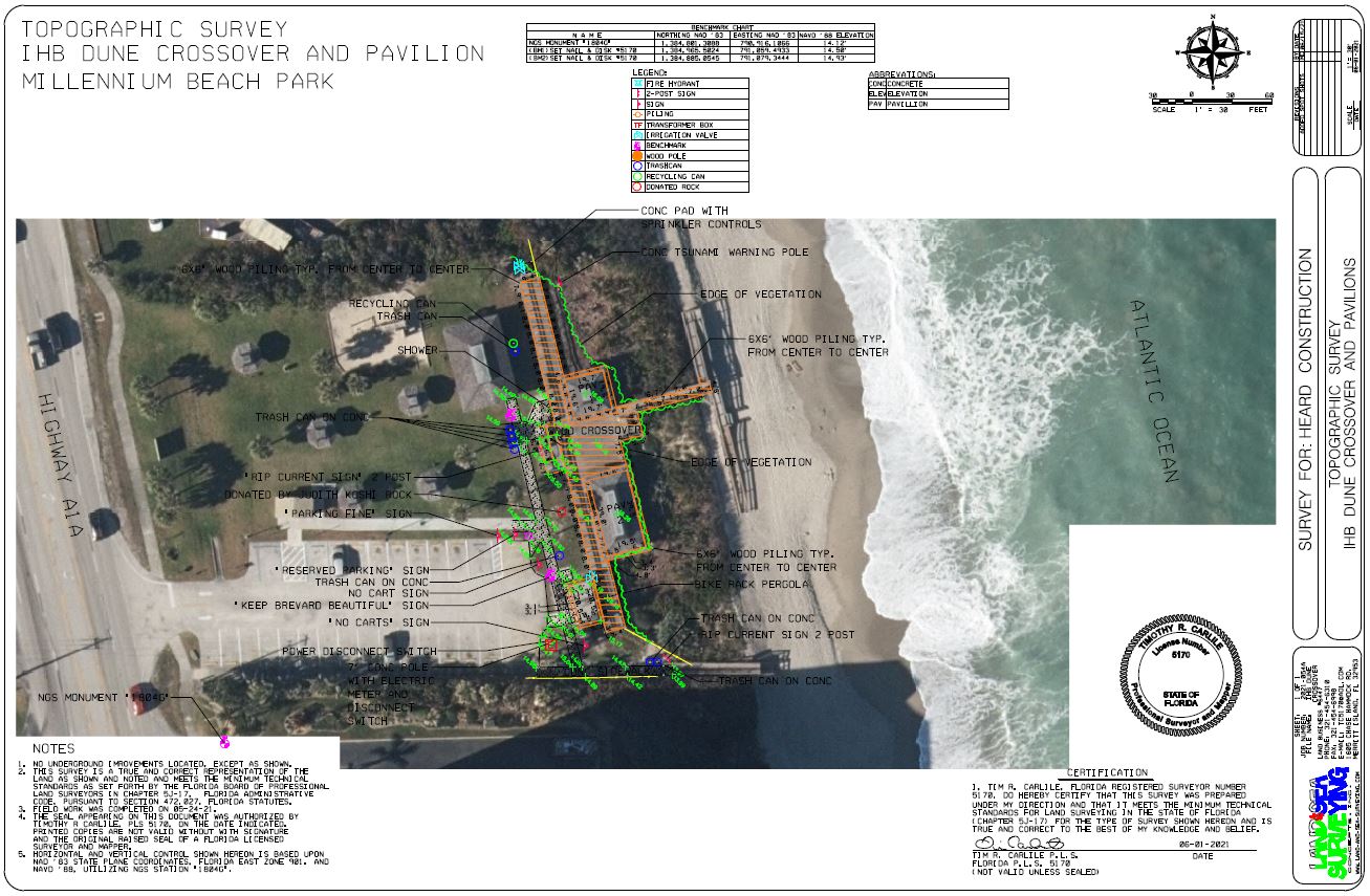
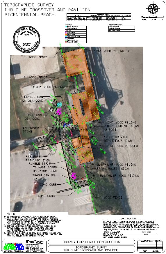
June 2021: Topographic Survey at Pavilion Bicentennial Beach
Land & Sea Surveying surveyed both parks for upgrades to meet ADA requirements.


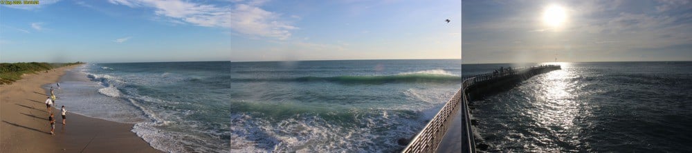
May 2021: Drone Survey of Coconut Point at Sebastian Inlet
Land & Sea Surveying performed an aerial drone survey at the Sebastian Inlet.
.JPG)
.JPG)
.JPG)
.JPG)
April 2021: Stennis Space Center Sanitary Sewer
Land and Sea Surveying located underground utility lines at Stennis Space Center in Bay St. Louis, Mississippi, totaling approximately 17000 linear feet.
.JPG)


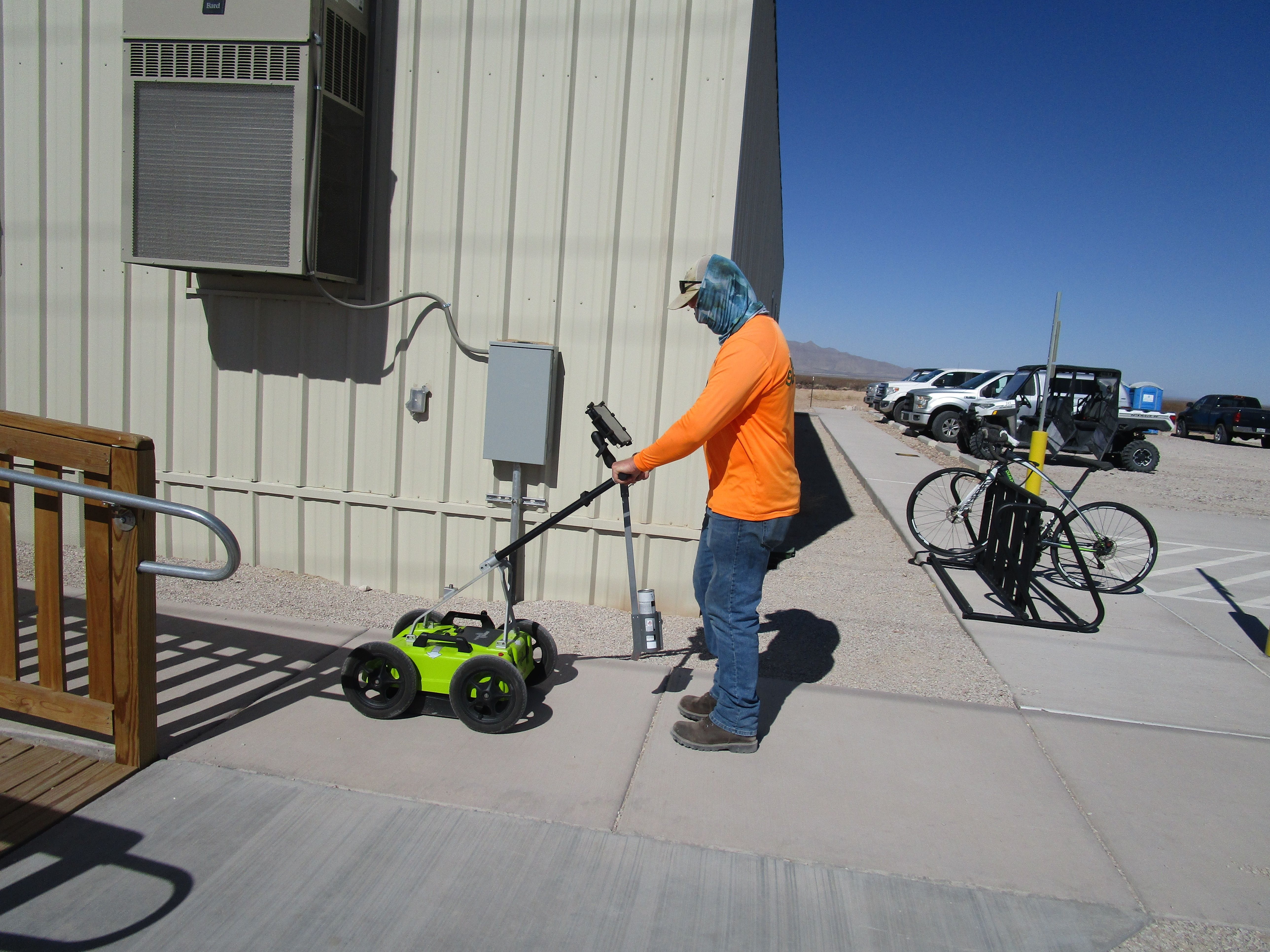
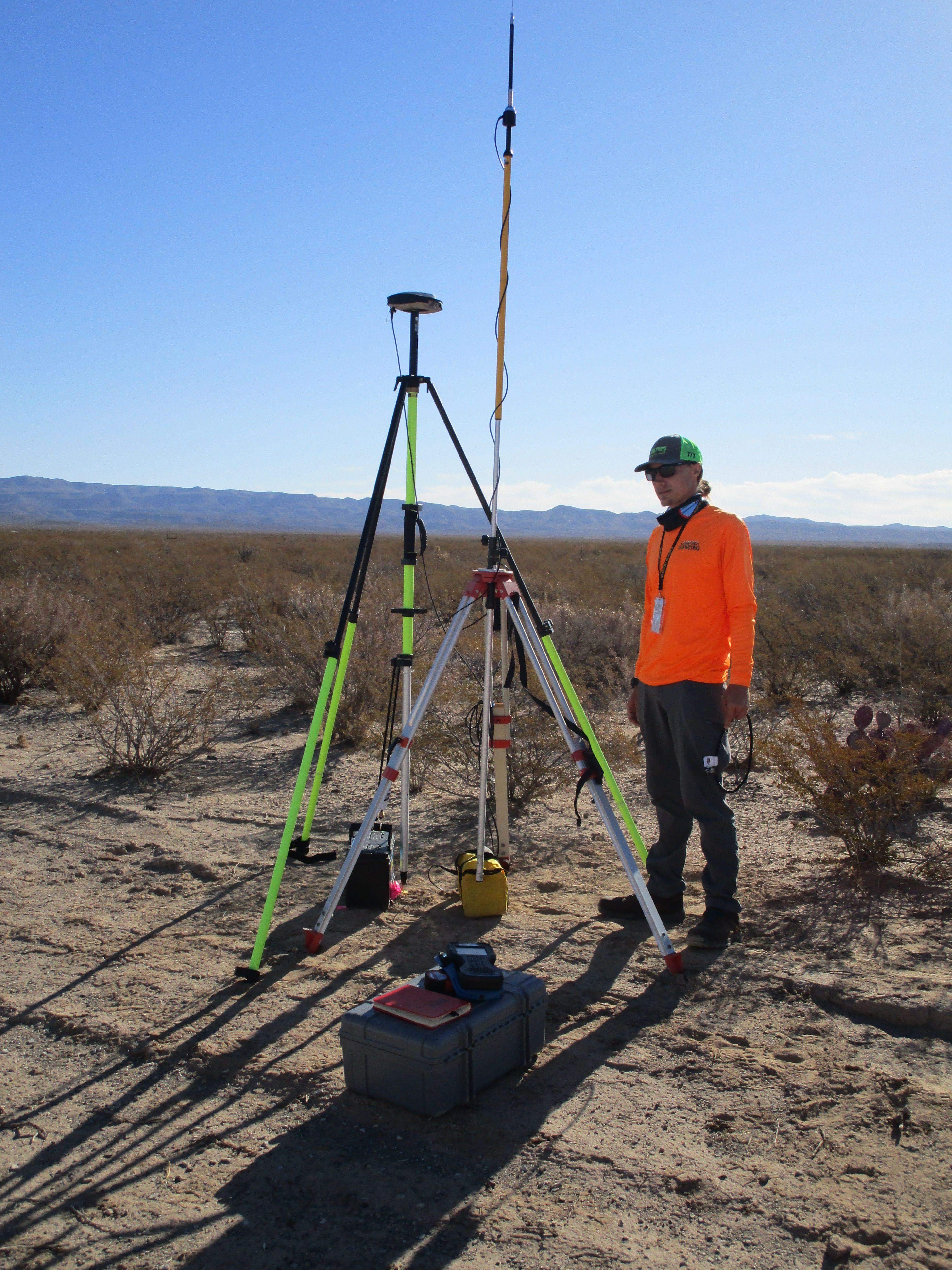
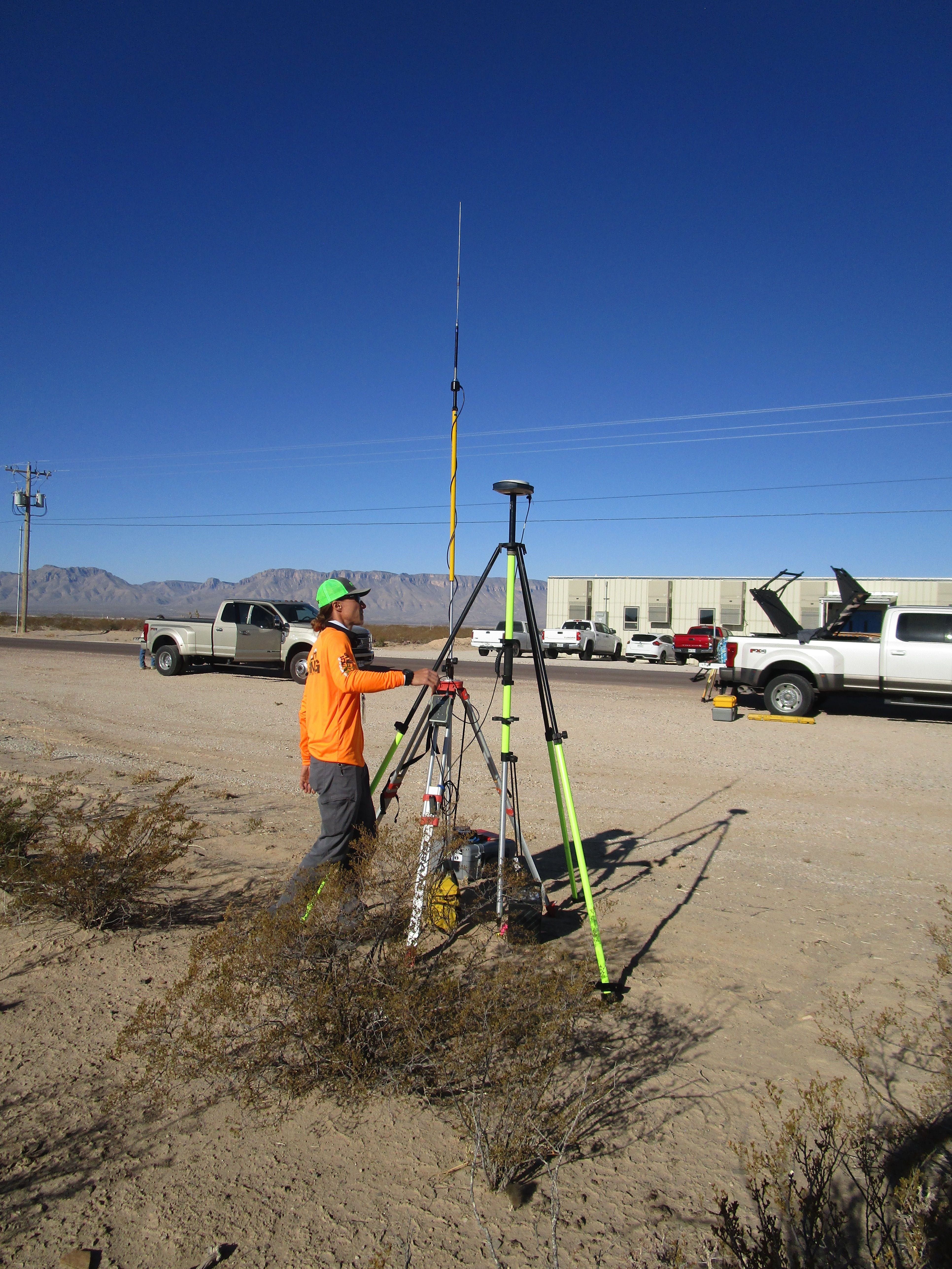
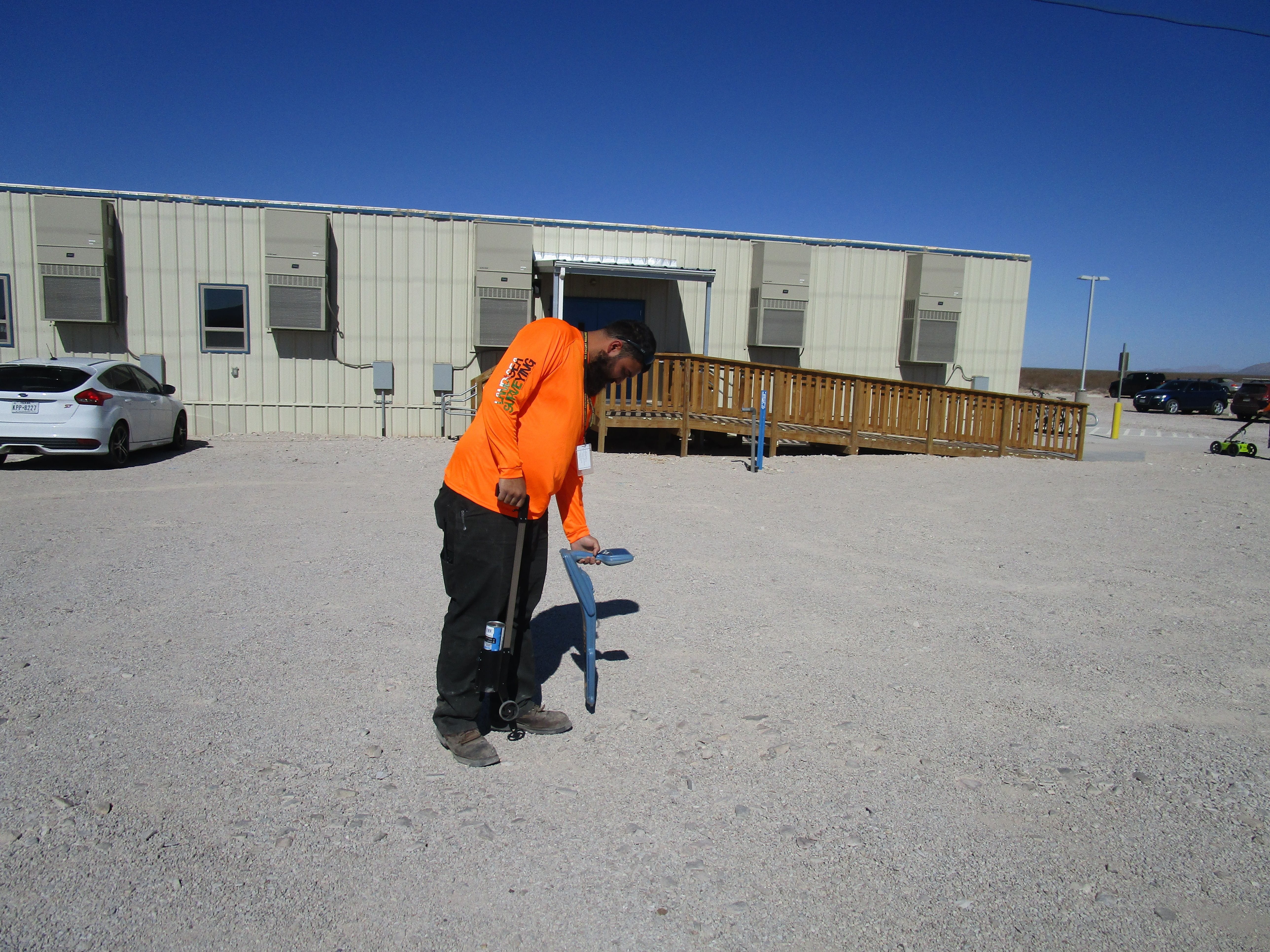
March 2021: Utility location at Culberson County, Texas
Land and Sea Surveying provided a utility survey and used the robotic Trimble total station, GPS equipment, RD8100 electromagnetic utility locator and a DJI Phantom 4 Pro Aerial Drone.
.JPG)

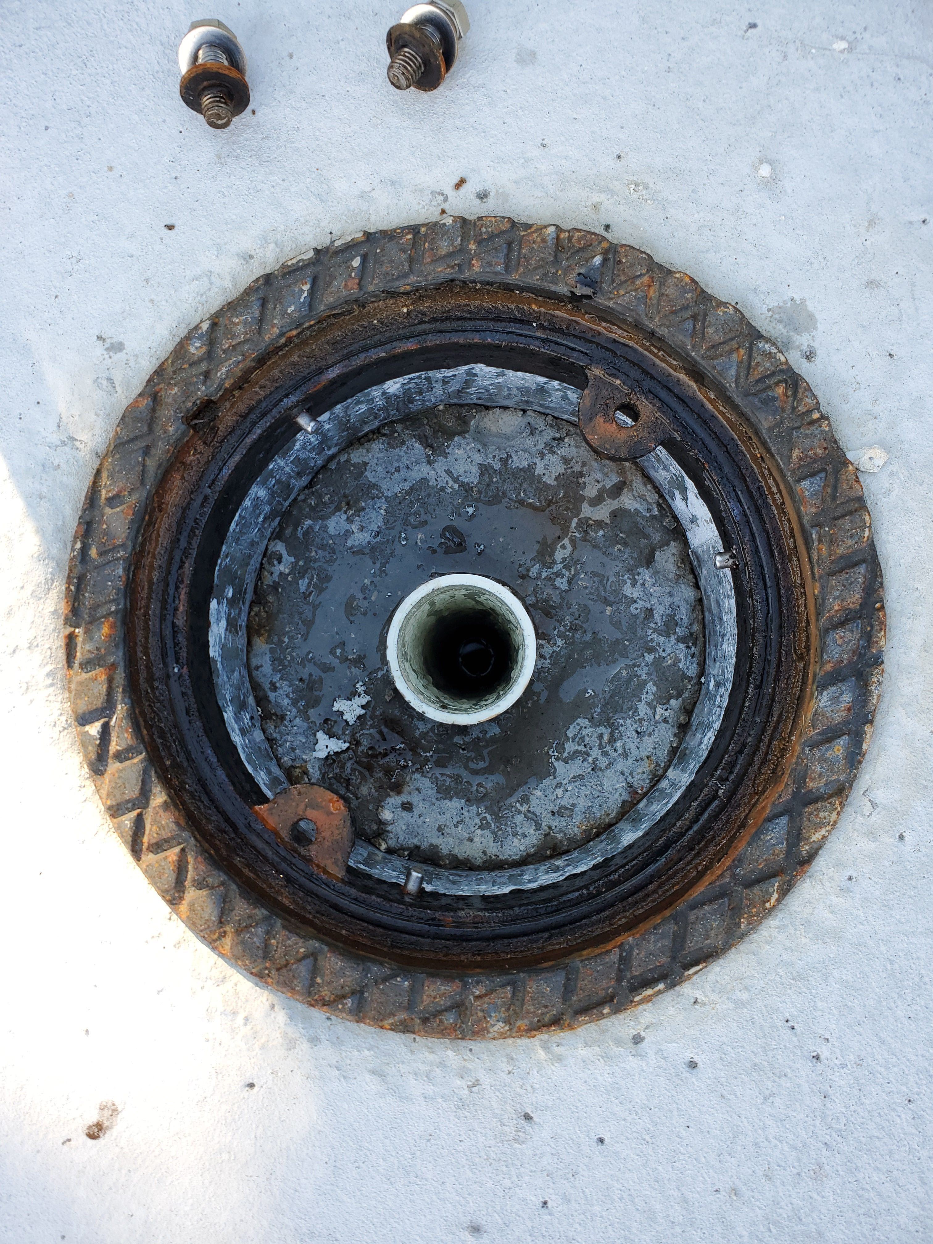
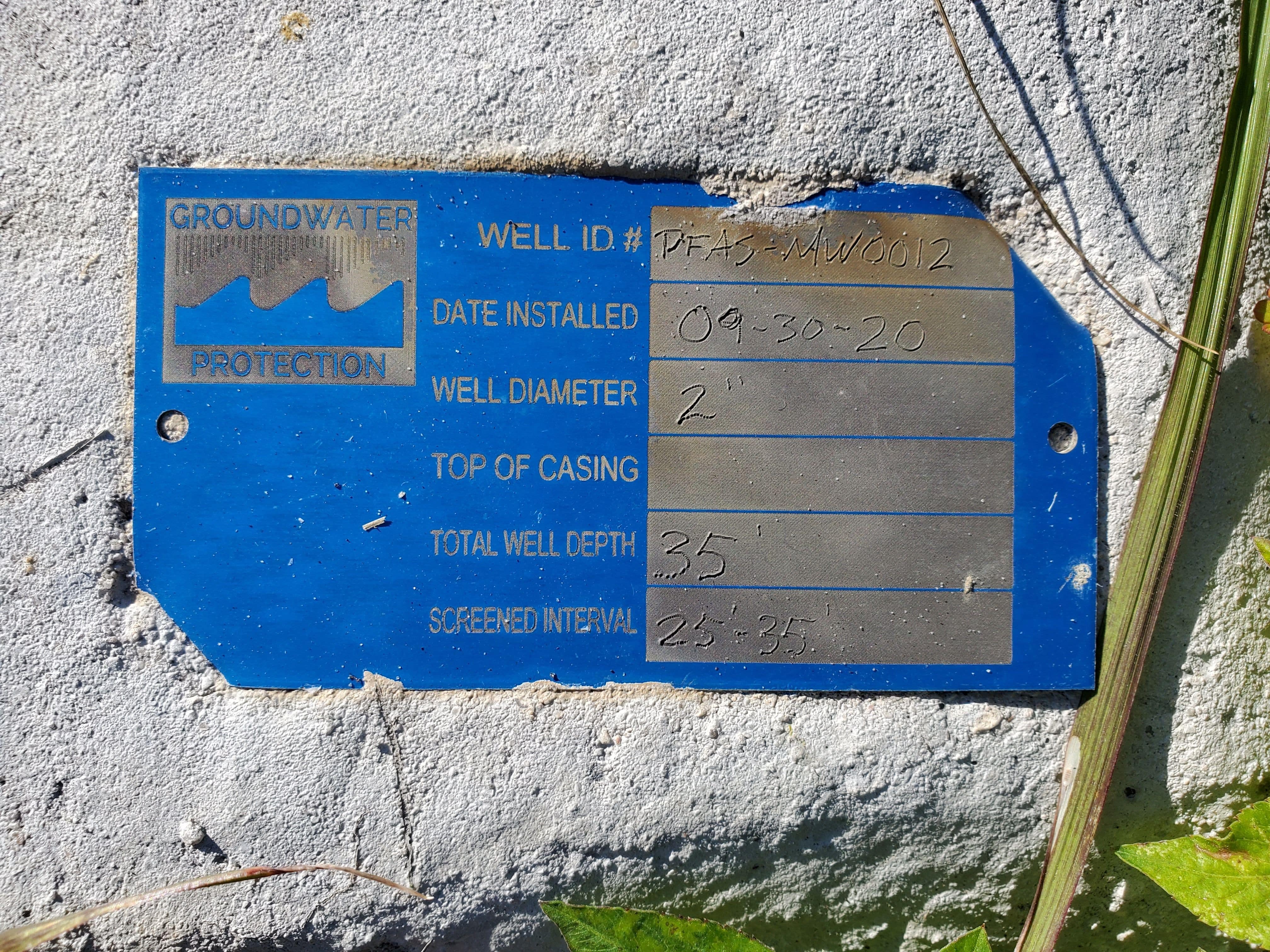
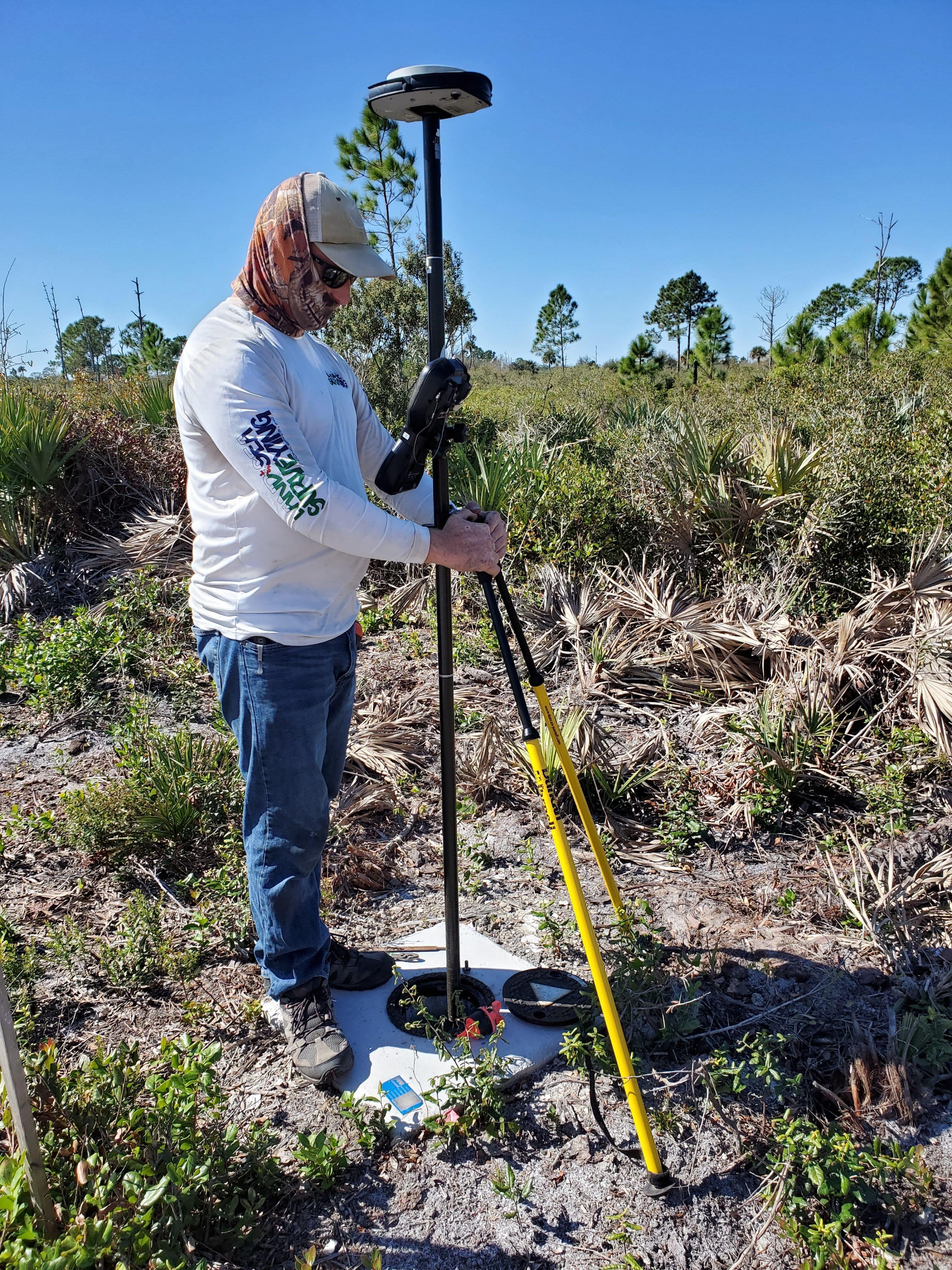
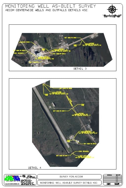
February 2021: Monitoring Wells at Kennedy Space Center
Land and Sea Surveying surveyed 13 monitoring wells and 3 outfalls with transducers at multiple sites on Kennedy Space Center.
.jpg)
.jpg)
.jpg)
.jpg)
.jpg)
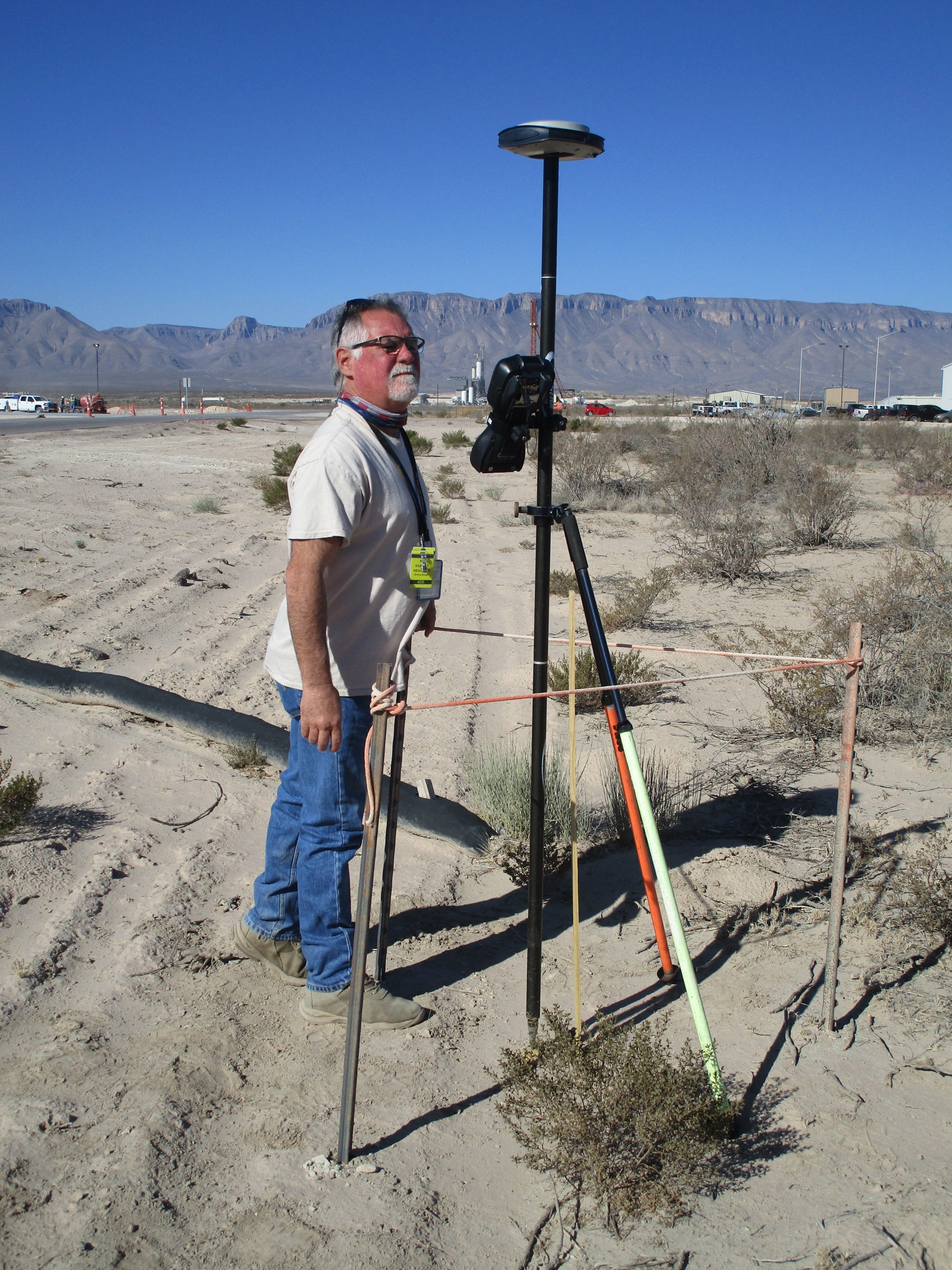
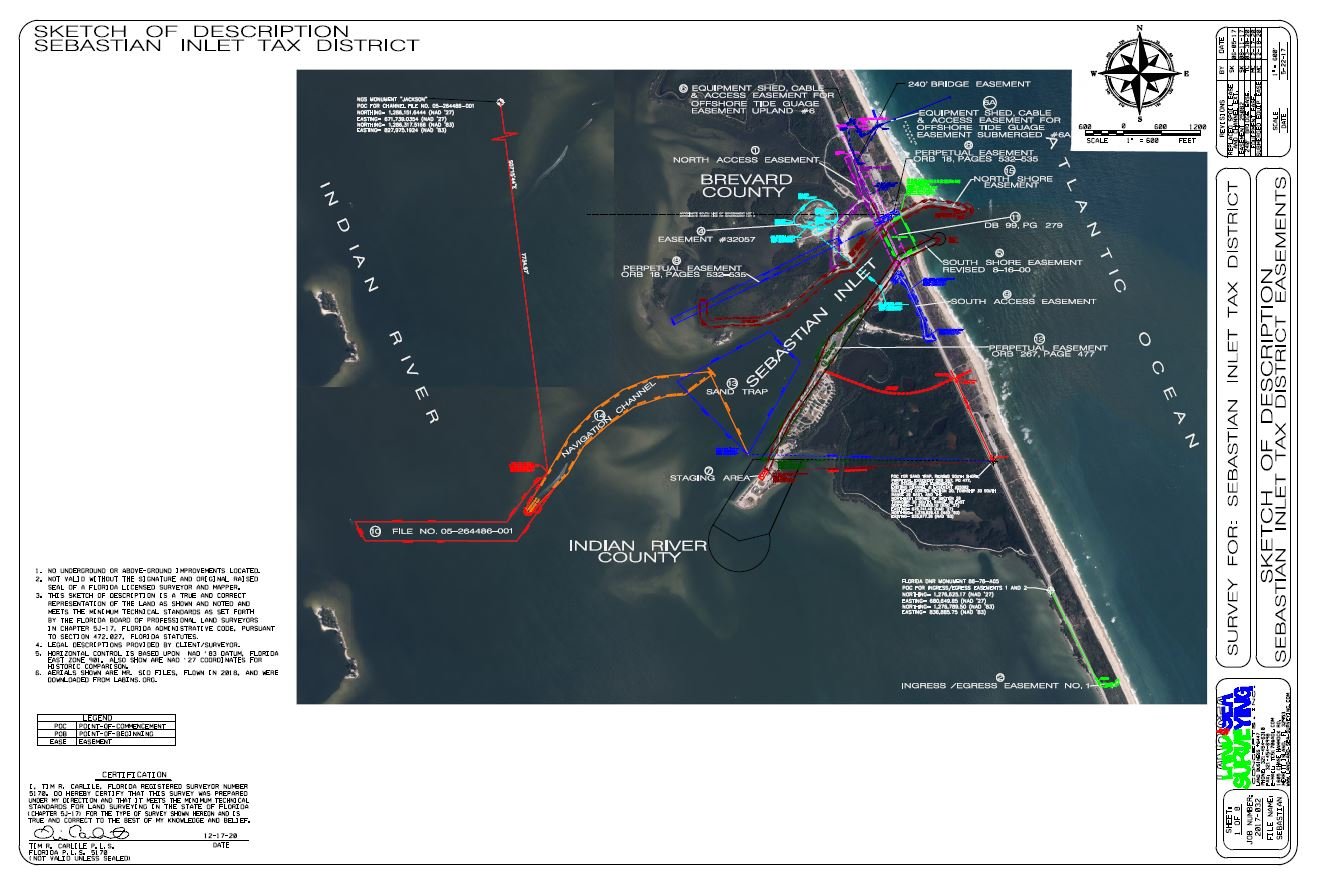
January 2021: Easement for Offshore Tide Gauge
Land and Sea Surveying provided services to rewrite the legal description for the Equipment Shed, Cable and Access Easement for Offshore Tide Gauge.
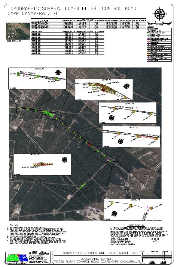
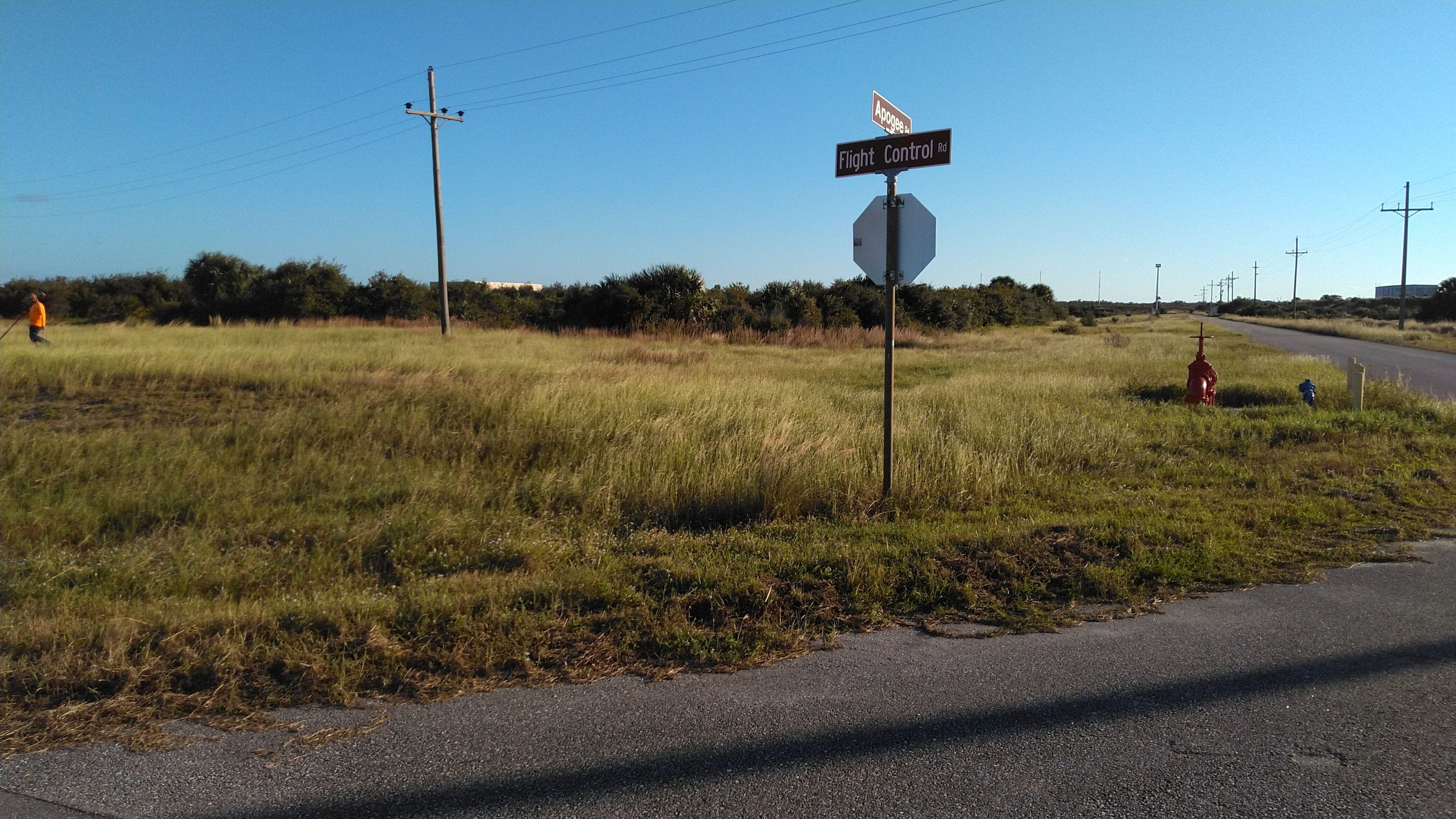
December 2020: Flight Road Control Road Underground Electric Survey
Land & Sea Surveying located all communications manholes with the rim elevations in the area. We also collected topographic data of the wet ditches for directional bore calculations and set benchmarks.


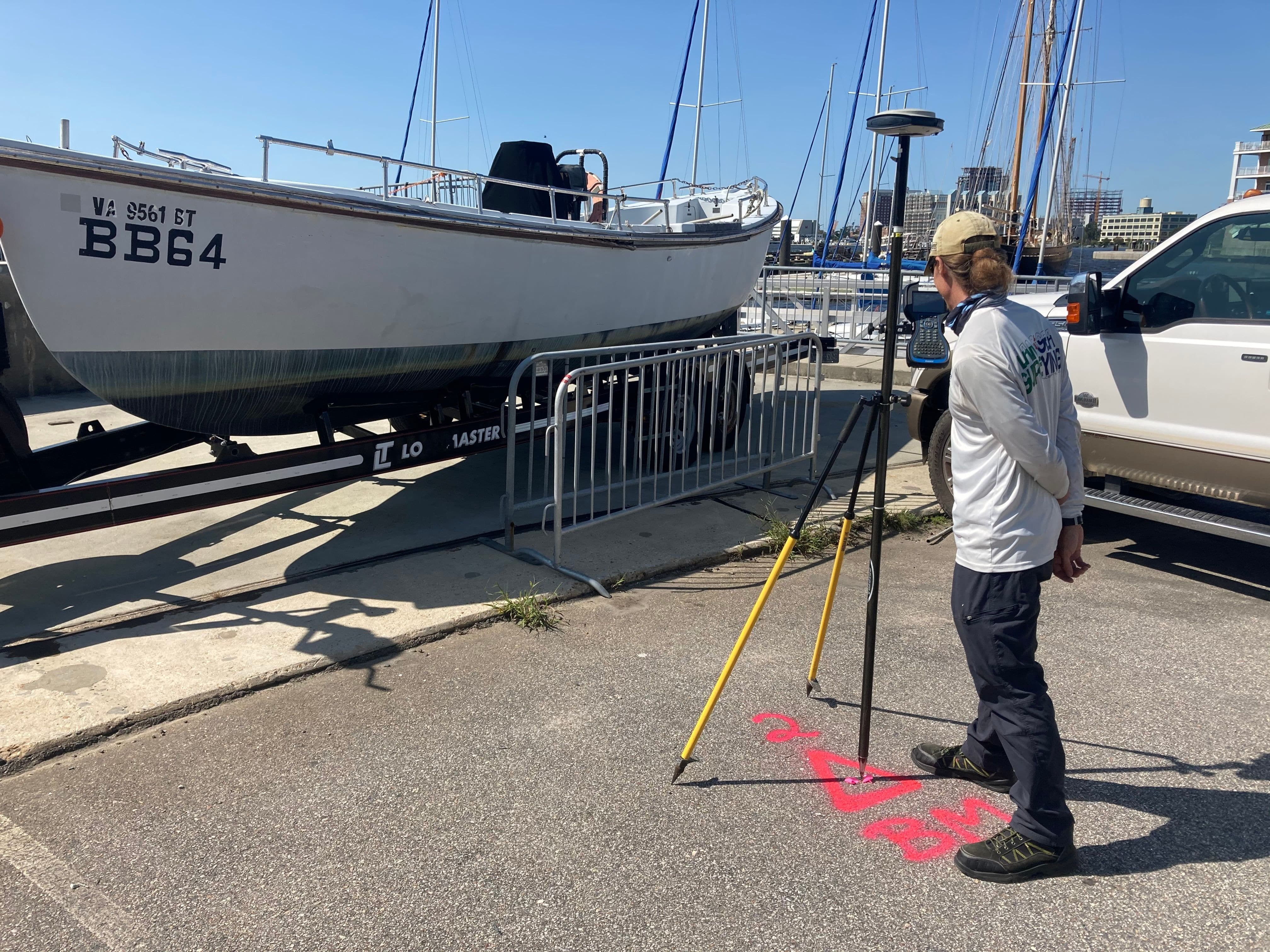
November 2020: Miami Beach Marina
Land & Sea Surveying provided a hydrographic survey of the outside pier area at the Miami Beach Marina.
.jpg)
.jpg)
.jpg)
.jpg)
.JPG)
.JPG)
.jpg)
October 2020: Semi-Annual Survey
Land & Sea Surveying provided surveying services at the Sebastian Inlet for the 2020 Semi-annual Survey including doing survey profiles at every full R-monument.
.JPG)
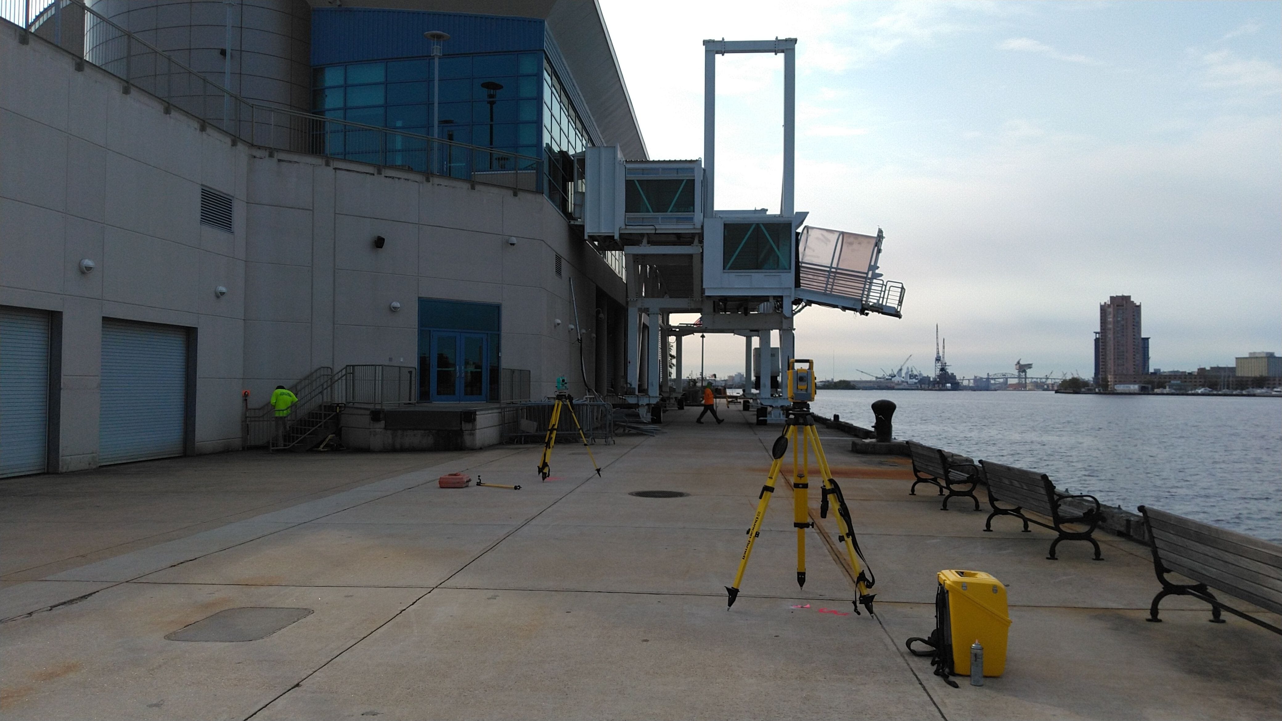
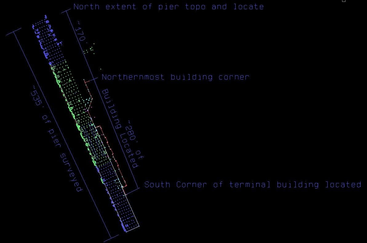
September 2020: Cruise Terminal
Land & Sea Surveying provided surveying services in support of the installation
of passenger gangway for the cruise terminal on the Elizabeth River.


September 2020: CCSFS Complex 30 Topo Survey
Land & Sea Surveying provided a survey of the site at LaunchComplex 30 on Cape Canaveral Air Force Station, approximately 2.3 acres.


.jpg)
September 2020: CCSFS Hangar Road Route Survey
Land & Sea Surveying surveyed Hangar Road from Phillips Parkway to Skid Strip Road, approximately 3,700 linear feet, on CCAFS.
.jpg)
.JPG)
.jpg)
August 2020: CCSFS North and West Gates
Land & Sea Surveying performed a Topographic Survey in the area around the CCAFS West and North Gate barrier on NASA Parkway.


July 2020: As-Built Survey Cocoa Riverfront
Land and Sea Surveying provided an as-built survey of the Cocoa Riverfront Park Promenade
.JPG)


July 2020: Waccasassa Staff Gauge Survey
Land & Sea Surveying Set Permanent Benchmarks on the Waccasassa River
.JPG)
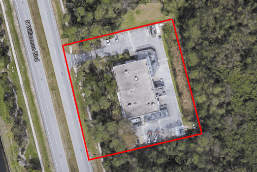
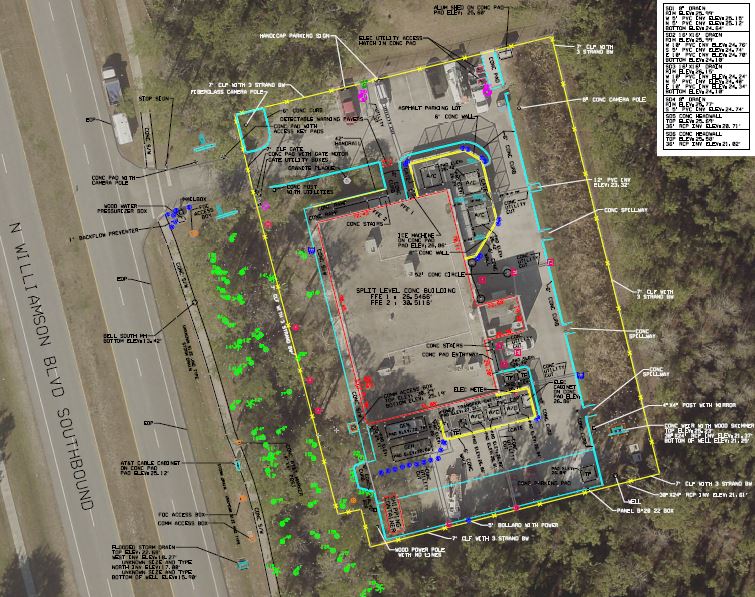
June 2020: Surveying at Daytona Beach
Land & Sea Surveying provided surveying services surveying services inWilliamson Boulevard, Daytona Beach

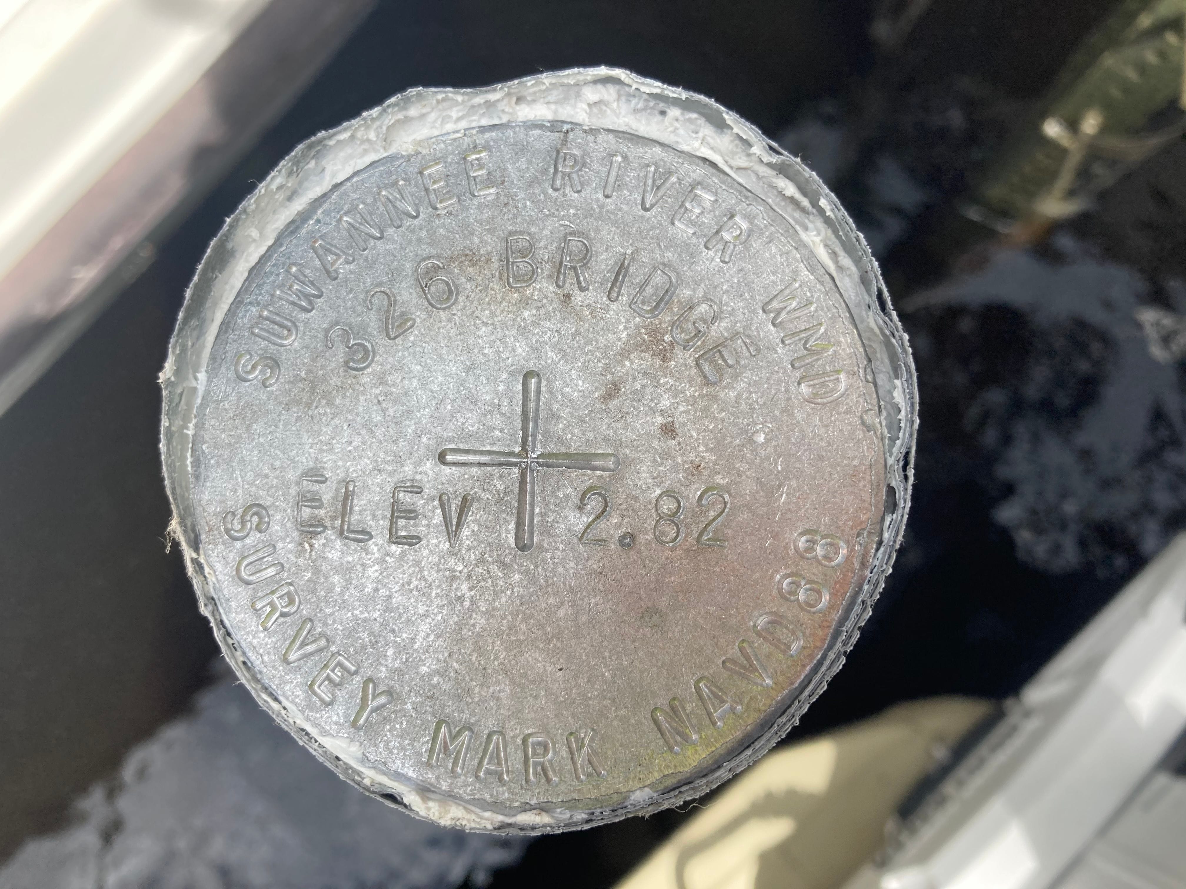
May 2020: Elevation Surveys at Monitoring Loctions for the Suwannee River Water Management District
Land & Sea Surveying provided surveying services toset benchmarks and establish elevations on existing benchmarks, measuring points, reference marksand staff gages at 20 sites


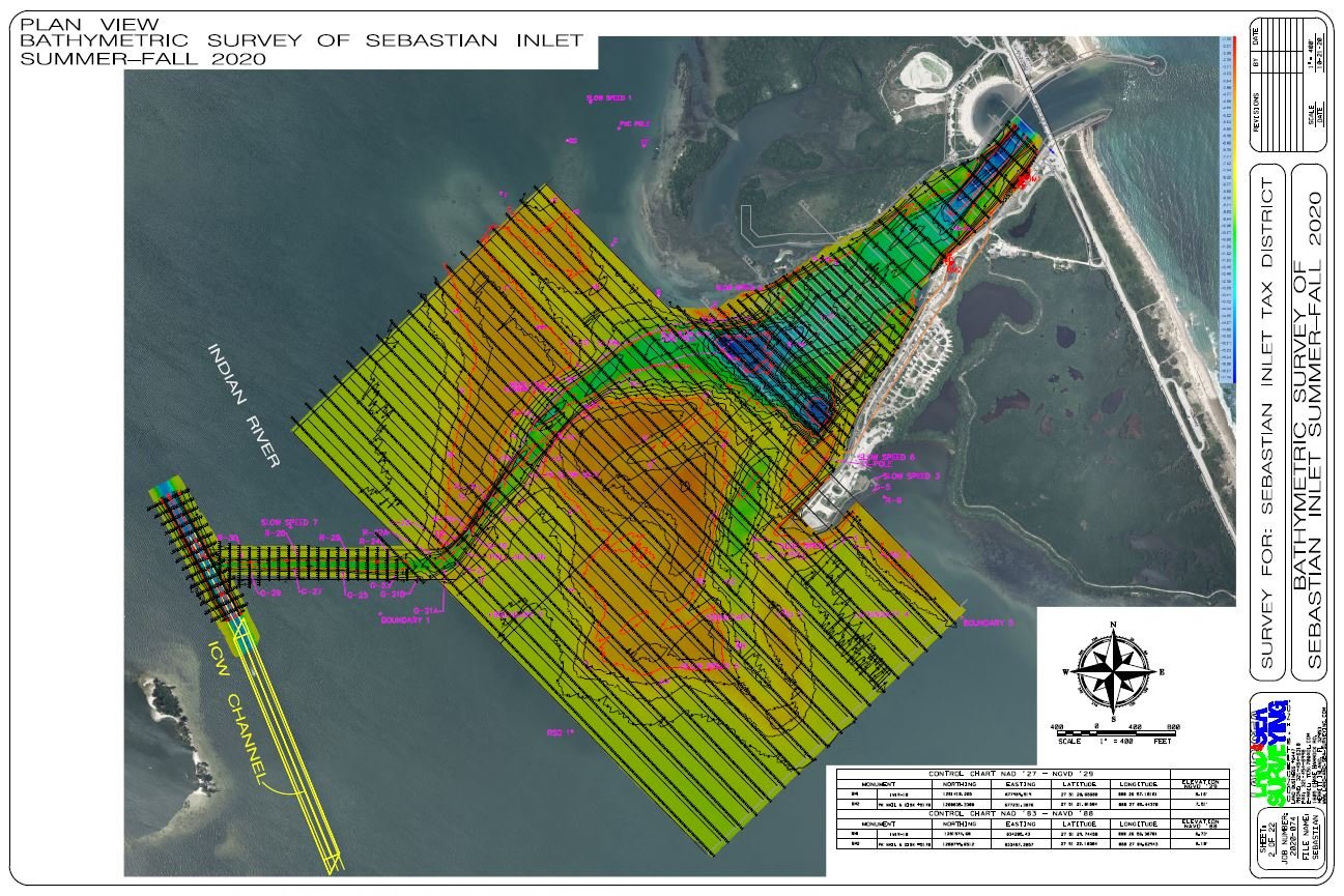
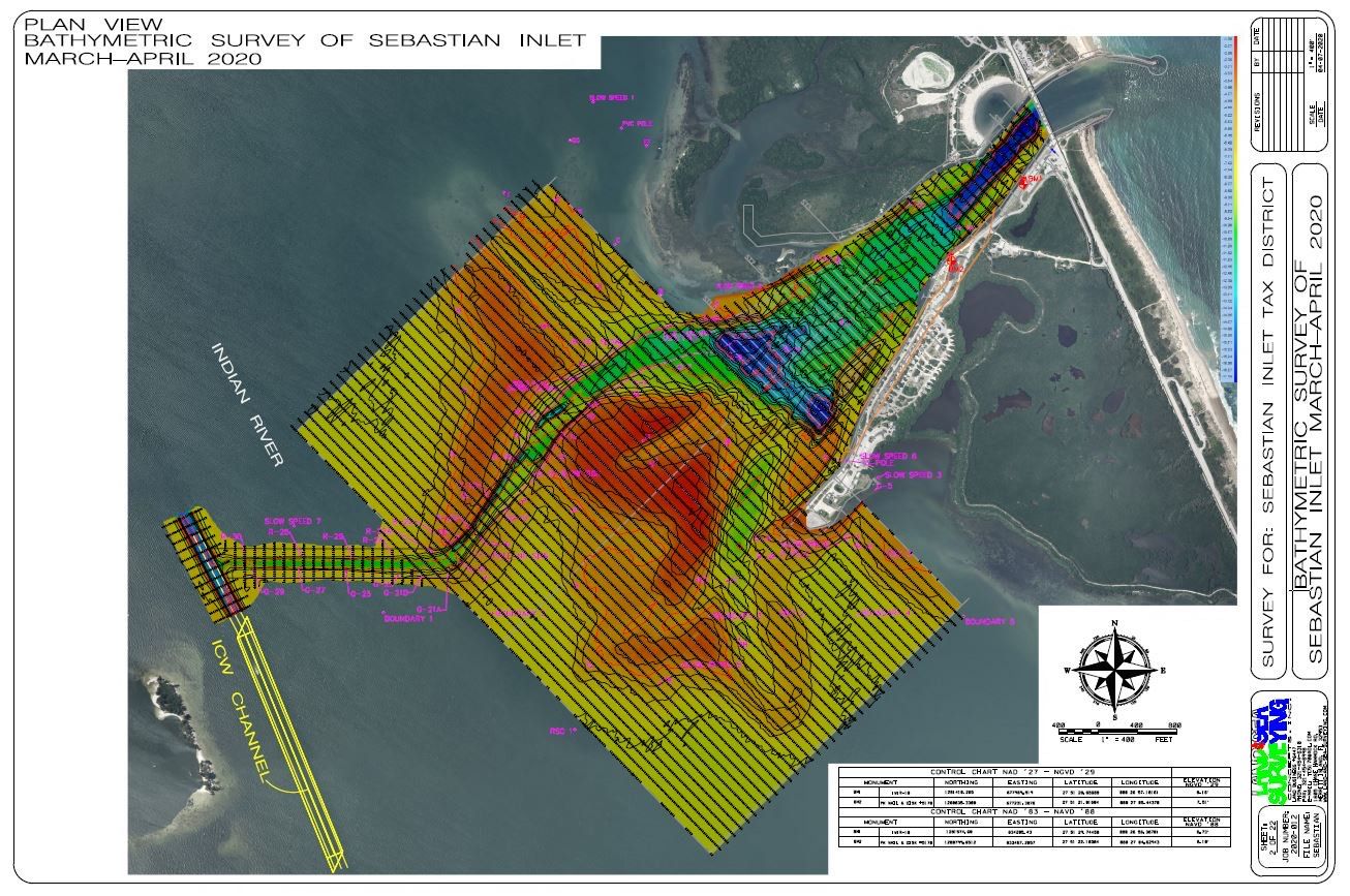
April 2020: Sebastian Inlet
Land & Sea Surveying performed the Semi Annual March/April Survey of the Sebastian Inlet. Surveying was completed using a Teledyne Reson Multibeam System, singlebeam systems and land-based RTK GPS survey systems.
May 2020: As-Built Surveys of Restrooms
Land & Sea Surveying provided as-built surveys of the new restrooms at Spessard Holland Park inMelbourne Beach
.JPG)

March 2020: ATX Building
Land and Sea Surveying completed a topographic survey, aerial drone survey and underground utility location with at the ATX building in Titusville, Florida.
.jpg)
.jpg)
.JPG)
.jpg)
.jpg)
March 2020: Sebastian Inlet A1A Easement
Land and Sea Surveying surveyed the provided legal description of the easement granted to the Florida Department of Transportation in July 1963 by locating the monumentation to accurately recreate the legal description.
.JPG)
.jpg)
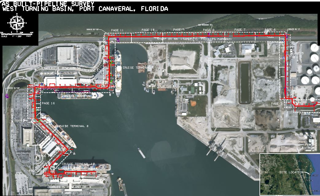
March 2020: Port Canaveral, FL.
Land & Sea Surveying completed a survey of 32 monitoring wells in Port Canaveral, Florida.
.JPG)

.jpg)
March 2020: Waccasassa River, FL.
Land and Sea Surveying completed a survey to assist scientists and environmental crews in establishing the elevation of different vegetation species along the Waccasassa River in North Florida.
.jpg)
.jpg)
.jpg)
.jpg)
.jpg)
.jpg)
.jpg)
March 2020: Coconut Grove, Florida
.JPG)
.jpg)
March 2020: Cape Canaveral, FL.
Land and Sea Surveying completed a boundary survey for the Scorpion Marina off Mullet Rd. in Cape Canaveral.
.JPG)
February 2020: Tides Survey
Land & Sea Surveying surveyed the area outlined, locating all above-ground improvements and topography, Florida.
.JPG)
.JPG)
.jpg)
February 2020: Merritt Island, FL.
Land and Sea Surveying performed a topographic survey on multiple sites on Kennedy Space Center for the Institutional Power Systems Safety and Reliability Project.
.jpg)
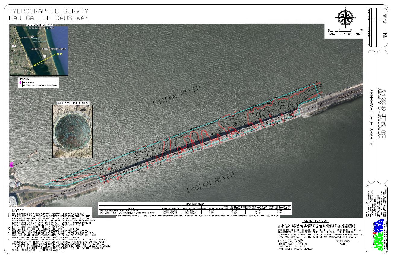
February 2020: Indian River Crossings
Land and Sea Surveying completed a hydrographic survey of the crossings of the Indian River at Merritt Island Causeway (SR520) and Eau Gallie Causeway (SR518). Survey was collected with and Odom Echotrac CV-100 single beam system.
.jpg)
February 2020: Cape Canaveral Stormwater Systems
Land and Sea Surveying provided a survey to support the work on the stormwater system along five drainage structures that were replaced.
.JPG)
.jpg)
January 2020: Lhoist Lowell Quarry
Land & Sea Surveying surveyed the lake using a Teledyne Reson SeaBat T50-R multibeam survey system on our 25 ft. SAFEboat. The system was tied to an Applanix Wavemaster POS-MV for motion corrections and RTK GPS positioning. The multibeam system provides 100% coverage of the survey area.
.JPG)
.JPG)
.jpg)
January 2020: Cape Canaveral, FL.
Land and Sea Surveying conducted a survey for the Cape Canaveral Air Force Station to determine the erosion along approximately 4,500 feet of shoreline.
.JPG)
.jpg)
December 2019: Launch Complex Rebuild Cape Canaveral, Florida
Land and Sea Surveying performed a topographic survey of the Launch Complex for new construction.
.jpg)
December 2019: Monitoring Wells at Kennedy Space Center, Florida
Land and Sea Surveying completed a survey of 8 monitoring wells at the Kennedy Space Center GSA reclamation yard.
.jpg)
November 2019: Louisiana River Crossings
Land and Sea Surveying completed several surveys of gas pipelines at multiple Louisiana River Crossings. The surveys included bathymetry with multibeam and singlebeam systems, side scan sonar, sub-bottom profiler, subsurface utilities locators and aerial drone systems.
.JPG)
.jpg)
.jpg)
.jpg)
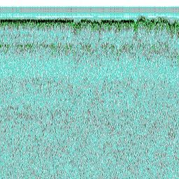
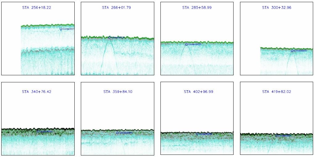
The images just above are data from the Sub-Bottom Profiler.
.jpg)
Despite the cold water temperatures our dive crew was able to collect all the data we needed with our Mesotech MS 1000 Scanning Sonar shown below.
.jpg)
October 2019: Georgia Pipeline Surveys
Land and Sea Surveying performed a Depth of Cover survey of pipelines at the Chattahoochie River, South River and Broad River in Georgia.
.jpg)
Just above Tim and Kyle setting up and operating the DJI Phantom 4 Pro Drone.
.JPG)
October 2019: Pipeline Inspection Survey, Tampa, Florida
Land and Sea Surveying completed an inspection survey for possible exposure of pipelines in the Gulf of Mexico using multibeam survey system and side scan sonar. This survey was completed utilizing two-25 foot survey vessels; one equipped with a multibeam system and the second with a side scan sonar to collect data simultaneously.
.jpg)
October 2019: Cape Canaveral, Florida
Land and Sea Surveying completed a topography survey for this 4.45 acres at the Cape Canaveral Air Force Station.
.JPG)
.jpg)
October 2019: Cape Canaveral
Land and Sea Surveying completed a description of boundaries to split 3 parcels on Mullet Dr. in Port Canaveral, Florida.
.JPG)
.JPG)
.jpg)
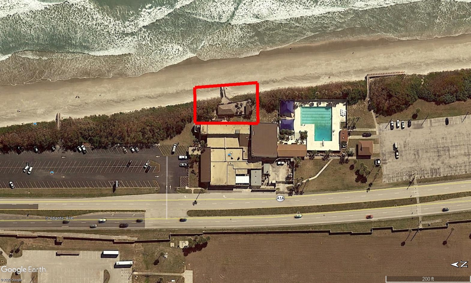
October 2019: Satellite Beach, Florida
Land and Sea Surveying performed a survey for the design of a new access gate for the Patrick Air Force Base Fire Department located on US Highway A1A.
.jpg)
September 2019: Lhoist Lowell Quarry
Land and Sea Surveying performed a survey on the Mine Lake in Lowell, Florida using a Teledyne Reson SeaBat T50-R multibeam survey system. The system was tied to an Applanix Wavemaster POS-MV for motion corrections and RTK GPS positioning.
.JPG)
.jpg)
September 2019: Tampa Bay
Land and Sea Surveying completed a survey to inspect the Gulfstream pipelines for possible exposure in the Tampa Bay area.
Above is data example showing a pipeline exposure.
.jpg)
September 2019: Skyway Bridge
Tampa, Florida
Land and Sea Surveying completed a survey to mark location of a Gulfstream Pipleine at the Skyway Bridge by using the position as previously surveyed. The buoys were set marking the location of the pipeline every 50 feet.
.JPG)
.jpg)
September 2019: Fort Lauderdale, Florida
Land and Sea Surveying completed a hydrographic survey of the marina basin for the Fort Lauderdale Boat show at Bahia Mar Marina.
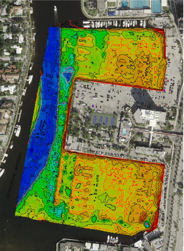
.JPG)
Land & Sea Surveying surveyed the marina basin to the center of the adjacent channel as outlined in red above, approximately 28.5 acres.
.jpg)
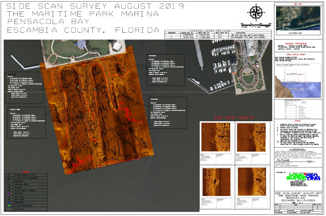
August 2019: Pensacola Bay Pilings
Land and Sea performed a hydrographic survey for for the city of Pensacola Bay from the seawall out approximately 1100 feet and 850 feet wide. The entire area was surveyed with an Edge Tech 4125 1600 kHz high resolution side scan sonar. Areas deeper than 6 feet (without any debris) were done using Teledyne Reson SeaBat T50-R multibeam system and an Applanix Surfmaster POS-mv inertial measurement unit for bathymetry.
.jpg)
August 2019: Hurricane Inspection
Land and Sea Surverying performed a post inspection survey for the pipeline segments in Texas that experienced hurricane force winds from Hurricane Barry that passed through July 12-13, 2019. Land and Sea completed the survey using a magnetometer, sub-bottom profiler and a multibeam/side scan sonar system.
.jpg)
.JPG)
July 2019: N. Padre Island Laguna Madre,
South Texas
Land and Sea Surveying performed surveys here for pipeline location, depth of cover and bathymetry using a magnetometer, sub-bottom profiler, multibeam echosounder and side scan sonar.
.jpg)
July 2019: Brazos River, Texas
Land and Sea Surveying completed a survey for the Brazos River Crossing in Brazo River, Texas.
.JPG)
.jpg)
July 2019: PAFB Water Tower
Land and Sea Surveying completed a topographic survey of the Patrick Airforce Base Water Tower using RTK GPS.
.JPG)
.jpg)
July 2019: Canaveral Seaport Piperack
Land and Sea Surveying marked the piperack easement at all corners for construction of the piperack at North Cargo Piers 1 & 2 at Port Canaveral.
.JPG)
.jpg)
June 2019: Cruise Terminal 8 & 10
Land and Sea Surveying completed a hydrographic survey of the cruise terminal areas.
.JPG)
.jpg)
June 2019: Port Canaveral Cove
Land and Sea Surveying completed a survey of the area from bulkhead out to the existing channel. The survey was performed with a Reson multibeam and an Applanix POS-MV motion reference unit.

.jpg)
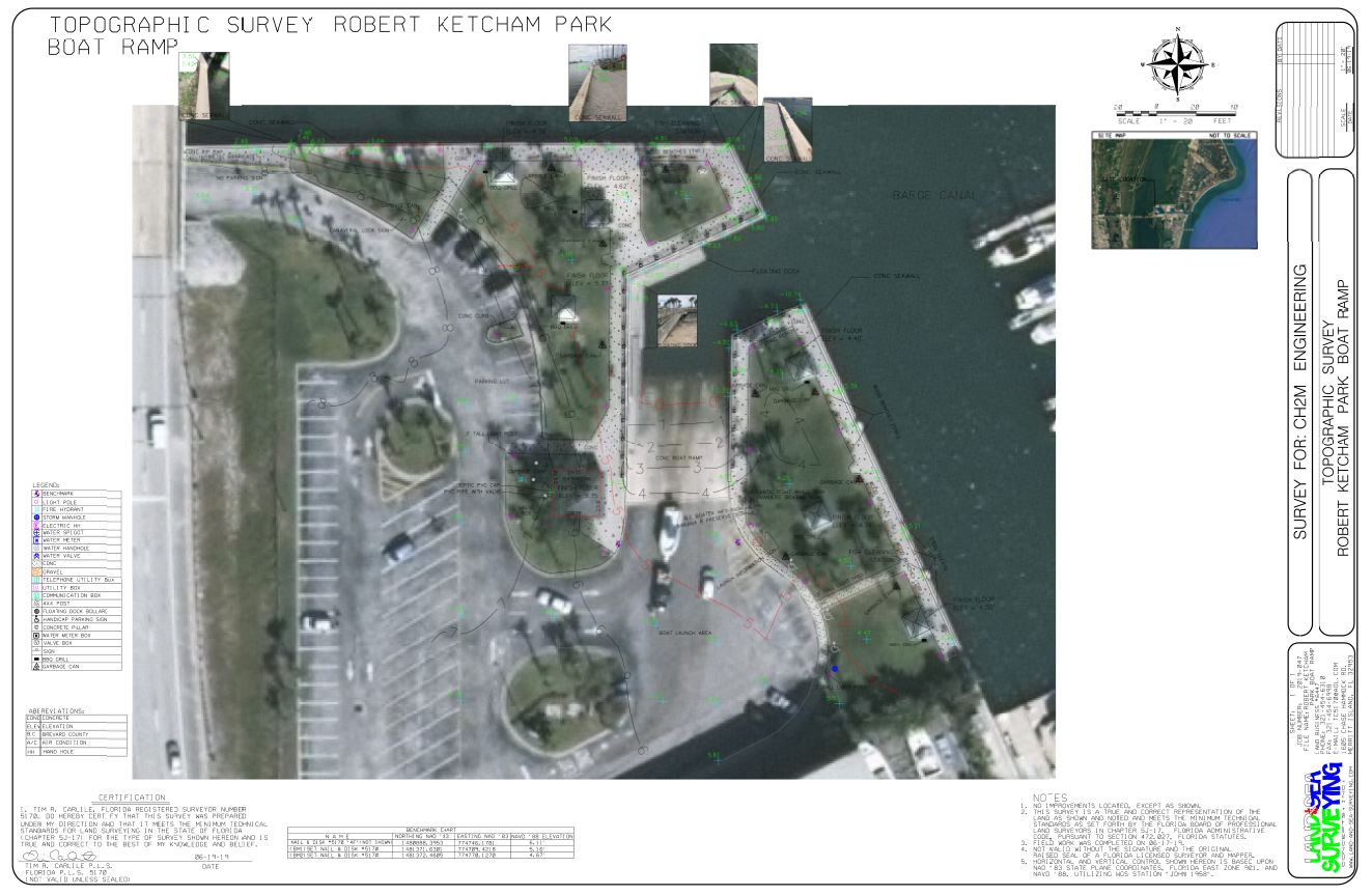
June 2019: Rodney S. Ketcham Boat Ramp
Land and Sea Surveying completed a topographic survey of this Cape Canaveral boat ramp using RTK GPS systems.
June 2019: AECOM Port Monitoring Wells
Land and Sea Surveying performed a survey for the temporary monitory wells using RTK GPS.
.JPG)
.jpg)
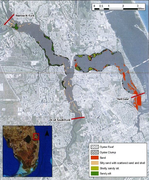
June 2019: St. Lucie Estuary Oyster Reefs
Land and Sea performed survey of oyster reefs in the St. Lucie Estuary with side scan sonar methods.
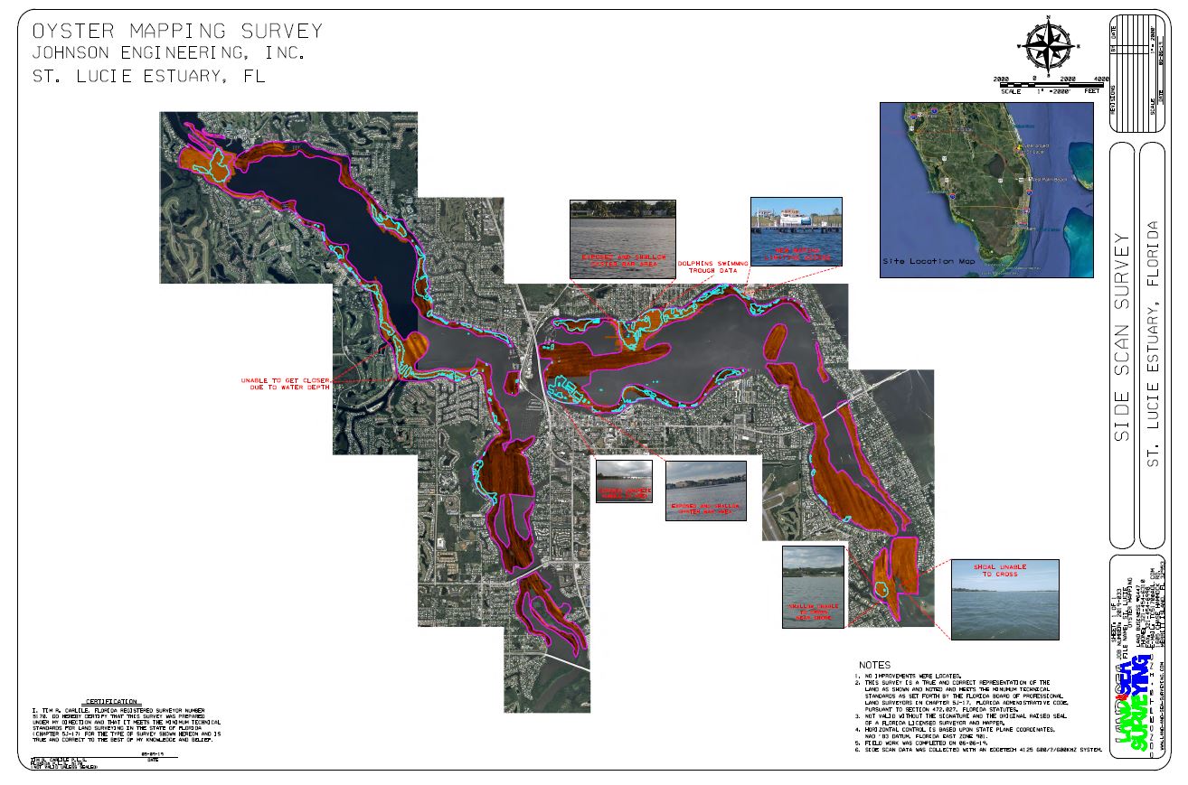
Upper left is a row of oyster bars. To the right is the Edge Tech 4125 side scan sonar used to scan the areas of suspected oyster reefs and oyster clumps.
Side Scan data collection
June 2019: Seaport Canaveral Fuel Pipelines
Land and Sea Surveying located and surveyed the length of underground pipelines using an RD8100 cable and pipe locator in Cape Canaveral, Florida.
.jpg)
May 2019: Sebastian Inlet
Land & Sea Surveying performed the Semi Annual Summer/Fall Survey of the Sebastian Inlet. We collected Multibeam data using Teledyne-Reson T50-R of the reef and Single-beam data was supplemented on upland and shallow areas with a land based RTK GPS Survey system collected of the offshore profiles, Inlet, Mouth, Shoals and the channel from the inlet to the ICW.
.JPG)
.JPG)
.jpg)
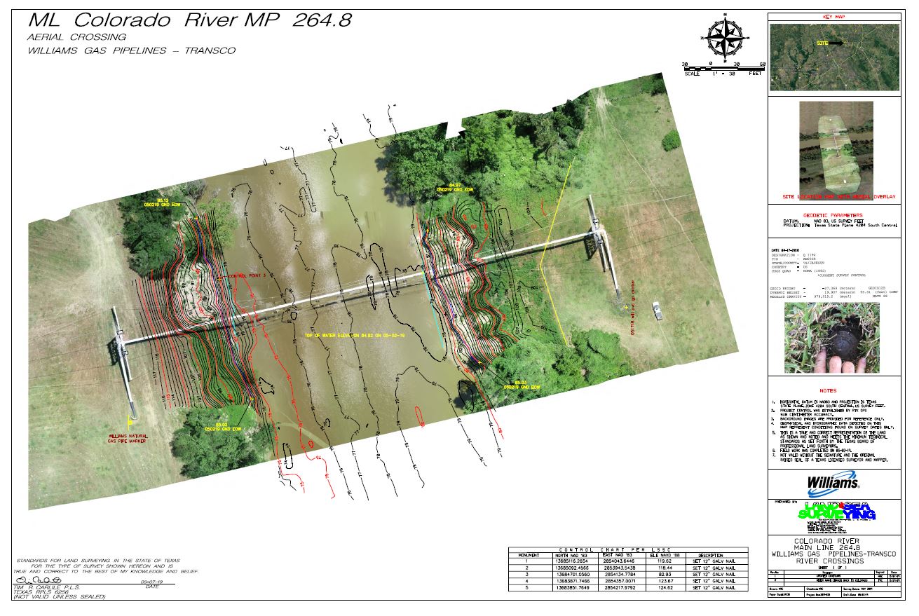
May 2019: Colorado River
Land and Sea performed a hydrographic survey of the Colorado River Crossing.
May 2019: Cape Canaveral Air Force Station
Land and Sea Surveying completed a topographic survey of building #1645 at CCAFS.
.JPG)
.jpg)
May 2019: Bahia Mar Marina Fort Lauderdale, Florida
Land and Sea Surverying performed a hydrographic survey of Bahia Mar Marina in Fort Lauderdale, Florida.
.jpg)
.jpg)
May 2019: Patrick Air Force Base Bldg. #1060
Land and Sea Surveying performed a topographic survey at bldg #1060 at Patrick Air Force Base.
.JPG)
.jpg)
April 2019: Merritt Island Visitor Center
Land and Sea Surveying performed a topographic survey of the Merritt Island Visitor Center.
.JPG)
.jpg)
March 2019: Louisiana River Crossings
Land and Sea Surveying completed a side scan, magnetometer, sub-bottom profiling, single beam and multibeam of pipeline crossings in various rivers in Louisiana.
.JPG)
.jpg)
.JPG)
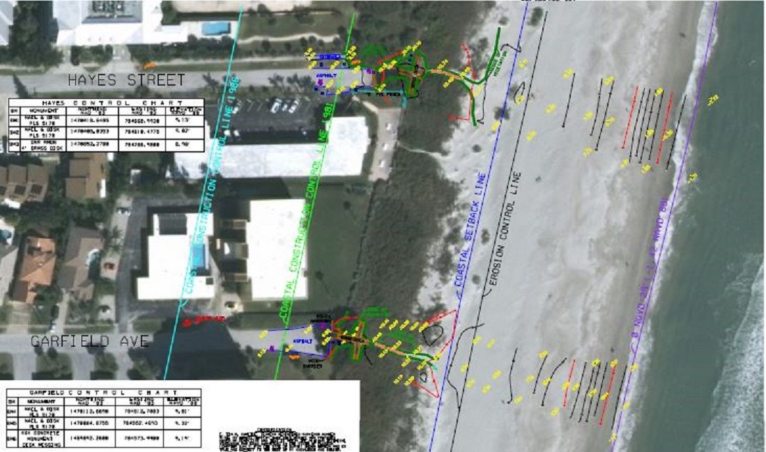
February 2019: Beach Crossovers
Land and Sea Surveying performed as built surveys of beach crossovers in Cocoa Beach, Cape Canaveral, and Satellite Beach.
.jpg)
January 2019: Gator Dredging Fort Pierce, Florida
Land and Sea Surveying performed a hydrographic survey ofFort Pierce Marina and the Entrance Channel.
December 2018: Brevard County D-2 Canals
Land and Sea Surveying conducted a bathymetric and muck depth survey from the canals within the County District 2 East Central area on Merritt Island. We established this using our 200kHz single beam survey system, manual probes and vibracores. Survey platforms included the Jet Ski Survey Vessel, the 20-foot Monark, and our 25-foot SAFEboat.
.JPG)
.jpg)
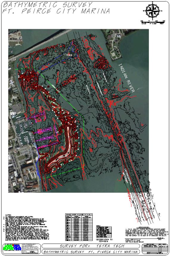
November 2018: Fort Pierce, Florida
Land & Sea Surveying performed the Annual Monitoring Survey of the storm protection islands at the Fort Pierce City Marine in Fort Pierce, Florida. Crews surveyed the area surrounding the islands from the western edge of the ICWW channel to the bulkhead outside of the marina basin. Land & Sea Surveying's FAA licensed crews surveyed the islands using an unmanned aerial drone to collect topographic data and real-time aerial images.
.jpg)
October 2018: Turkey Point Homestead
Land & Sea Surveying performed a bathymetric survey of the Barge Turn Around Canal and Turtle Point Canal in Homestead, Florida. Land & Sea Surveying crews surveyed both canals using a 200 kHz single beam hydrographic survey system.
.jpg)
October 2018: Alabama Fishing
Land & Sea Surveying provided our 20-foot Mako vessel, 25-foot safe boat, Captain and field technicain to assist scientists with the collection of large mouth bass and water samples on Lake Wheeler in Decatur, Alabama.
.jpg)
October 2018: Vermillion, Louisiana
Land & Sea Surveying perfomed a depth of burial survey of gas pipelines in Vermillion, Louisiana. Land & Sea Surveying crews located and positioned three pipelines and obtained depth of cover from the seabed to the top of the pipe and collected bathymetry left and right of the pipe.
.jpg)
October 2018: Borrow Pit
Land & Sea Surveying performed a bathymetric survey to determine depth and side slope to an existing borrow pit with a sunken crane inside in Cocoa, Florida. Crews utilized a T50-R multibeam survey systm for 100% coverage of the area and for the shallow areas used our jetski survey vessel with a singlebeam system, 200 kHz transducer and RTK GPS. Provided, was a crane that lifted our 25-foot 10,000 pound survey vessel from the trailer and into the borrow pit along with our jet ski survey vessel.
These multibeam images are showing an old crane submerged in the water from a previous incident.
September 2018: Wheeler Lake
Land & Sea Surveying provided vessels and operation as well as assisting navigation to support an ADCP (Acoustic Doppler Current Profiler) operation and water sampling on Wheeler Lake in Alabama.
Above: ADCP Transects
Below: The green dots are the individual locations of where the scientist took water samples.
August 2018: Sebastian Inlet
Land & Sea Surveying performed the Semi Annual Summer/Fall Survey of the Sebastian Inlet. We collected Multibeam data using Teledyne-Reson T50-R of the reef and Single-beam data was supplemented on upland and shallow areas with a land based RTK GPS Survey system collected of the offshore profiles, Inlet, Mouth, Shoals and the channel from the inlet to the ICW.
.jpg)
July 2018: Waccasassa River
Land & Sea Surveying collected bathymetric data along the Waccasassa River using our 20-foot Monark and jetski survey vessels. We continued surveying 3 tributaries along the river and extended out to the mouth of the river into the Gulf of Mexico.
.JPG)
.jpg)
June 2018: Barbuda
Land & Sea Surveying performed a singlebeam and sub-bottom hydrographic survey along the southwest coast of Barbuda.
.JPG)
.jpg)
June 2018: Port Canaveral CT-3 Post Demolition Survey
Land & Sea Surveying performed a topographic and aerial drone survey at Port Canaveral CT-3 after Demolition.
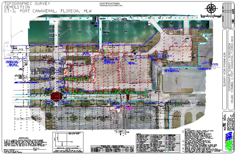
Aerial Views of CT-3 post demolition using the DJI Phantom Pro drone.
June 2018: Viscaya
Land & Sea Surveying performed an aerial drone survey of the edge of the shoreline along Lake Serene, Big Sand Lake and Little Sand Lake . Land & Sea Surveying flew the drone on 4 sites where Aerial imagery was taken with a DJI Phantom 4 Pro drone. The drone recorded three-dimensional images of upland features.
.jpg)
.JPG)
.JPG)
.JPG)
May 2018: Louisiana Pipeline Crossings
Land & Sea Surveying performed a pipeline inspection survey of the pipeline at road and culvert crossings starting at the Sabine River at the border of Texas and Louisiana heading east using an aerial drone. Land & Sea Surveying crew flew each site with the aerial drone on a pre-programmed flight plan to cover the entire area of the pipeline and collect three-dimensional aerial images. They also used the RD8100 to locate the pipe and determine the depth of burial.
Photometric three-dimensional point cloud images collected using the drone. The point cloud data is used to create topography of the site.
Aerial imagery of the project sites shown just above using our DJI Phantom 4 Pro Drone.
April 2018: South Texas Pipeline Crossings
Land & Sea Surveying performed a pipeline inspection survey of 32 river crossings across the south Texas region. Employees used a Radiodetection RD8100 locator along with manual probes to locate the pipe along these 32 river crossings as well as a DJI Phantom 4 Pro to provide up to date aerials, and also to collect topographic data in the upland areas.
.JPG)
.jpg)